When you live in one place for a long time, particularly during your growing up years, the place becomes a part of your being, a part of your soul, almost a part of your skin.
My three brothers and I were fortunate to live in places of great beauty during our childhood. And, from a morning’s first light slipping down a mountainside to evening’s softening the edges of a forest with shadows cast by the setting sun, certain sounds, sights and smells can instantly bring back a memory.
Along with impressions of the senses are names of places used over the years. Often names that evolved over time. We didn’t find our way so much by signposts as by the names of places that were established through living with the land.
Drive through a subdivision today and you may see Walnut Avenue, where a walnut tree has never grown. Or Meadowview but the subdivision has been built on what used to be a meadow. There were no street intersections (11th and Chambers) or big box stores (Macy’s and Sears) to be used as landmarks.
Those that were manmade, such as buildings or roads, usually had a name that had meaning. We used real “land” marks as do most rural dwellers. And behind many names were stories. Our landmarks were unique, one of a kind, never to be replicated. Not any where. Not any time.


Castle Crags State Park/Family Place Names
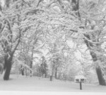
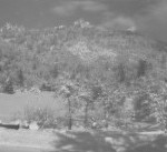
Photos by Mary Twight–left is meadow, Kettlebelly Ridge & Crags; right is our backyard– under the oaks a bird feeder.
Kettlebelly Road: A road that went past our house and up Kettlebelly Ridge. A portion of it was part of the old California-Oregon Toll Road used by settlers on their way west. The road terminates after a mile at a turnaround with a view of Mt. Shasta to the north. It was also where one parked to hike the trail to Castle Crags or Root Creek. Kettlebelly, I’ve learned, is the name of a type of soil found in this very northern part of California in Shasta, Siskiyou, Trinity and Modoc Counties as well as in Western Oregon and Washington. The soils drain well but also hold water. They are formed mostly from material weathered from basic rocks and most have a forest vegetation. I’d truly hoped that it was named after someone’s big belly!
Silverslipper Campground: This campground was already named when we moved there, fewer than 20 campsites perched along a small stream that wound down a hill. When I was in elementary school in Castella the school picnics were held there and I remember swinging on grapevines along the slope on the far side of the creek.
Bob’s Hat: A turnaround area that had a round patch of brush growing in the center. For years Bob Coon was the much loved and respected district superintendent for our area and always wore a Tam ‘o Shanter. About 10 years ago, when I went to Bob’s Hat, the center of his hat was sporting tall trees.
The Water Source: My father built a small dam across Indian Creek. A pipeline was put in there leading down the hill to two large concrete water tanks that supplied the campgrounds and houses with clean, reliable water. Access to The Water Source was via a dirt service road.
The Meadow: A large, sloping meadow at the park’s entrance. Sometimes during the winter we would make a toboggan run down the steepest part. My eldest brother has told me that in the old days, before becoming part of the park, this meadow (and others in the area) was used for growing strawberries. He says that pipes with small sprinklers were dug up during some construction along the edge of the meadow. We hunted Easter eggs much l longer than most children and the upper end of the meadow was a great place for hiding them. Our mother even climbed small pine trees to make the hunt more challenging.
Sevenman Campground: This was a new set of campsites designed and laid out by my father and named after Dr. Sevenman who owned an old two-story house across Highway 99 (Now Interstate 5) where he would often stay during the summer months. Dr. Sevenman, who lived in the San Mateo area, looked like a jovial Santa Clause and one of his favorite sayings was “maaaagNIFicent!” Sevenman Campground was above The Meadow.
The Gully: A small stream ran from near the top of the meadow down past our house and the park office, under the highway, and eventually to the Sacramento River. The Gully was filled with riparian vegetation including blackberries, which we picked every year so that our mother could make quarts and quarts of jam and jelly. We considered the entire length of this stream up to the road at the top of the meadow to be The Gully.
The Hairpin Turn: A sharp turn in Kettlebelly Road where my brothers killed a rattlesnake (see previous story about rattlesnakes) and tourists held their breath as they negotiated it.
The Dump Road: A dirt road leading to what for a few years was the park garbage dump. My younger brother remembers it as the Quarry Road because there was a decomposed-granite quarry there.
The View: Where Kettlebelly Road ends at a parking lot with a view of Mt. Shasta.
The Ditch: A water ditch that ran from Indian Creek around the hill and supplied water to the park as well as to some Castella residents. Sometimes in the winter it would freeze and the rangers would take axes up to chop out the ice. Sometimes the downhill side would break or be damaged by a falling tree and everyone would be suddenly without water, a situation calling for immediate repairs. My younger brother remembers dipping buckets of water out of The Gully to use in the house when either of these events occurred. To walk along the ditch in the summer was very pleasant with the shade of the trees and the smell of wild mint underfoot. Five-finger ferns and tiger lilies grew here.
Broken Toe Springs: Along the dirt road to The Water Source was a small bog sporting carnivorous pitcher plants and blossoming azaleas. I remember spending time there with our mother on a warm spring day watching a male Anna’s hummingbird soaring up almost out of sight and then diving down in a big arc to impress his potential mate. There was a wooden sign here saying Broken Toe Springs. I’m sure there’s a story behind that.
The House: Our house (see previous story) was the only house in the park on the west side of the river until a new ranger residence was built up the hill from us. Before that second house was built we used to climb in the apple trees of a small orchard there.
The Orchard: We’d perch on the rail fence next to The Orchard to watch trains going on the track between the highway and the river. These old trees were riddled with hoIes made by sapsuckers. I can still immerse myself in that profusion of fragrant apple blossoms and hear the honey bees, sun warm on my shoulders.
The Shop: A brown building with partially rock walls located above The Gully and used for repairing whatever needed working on in the park. There was a slanted rack there to put garbage cans on for cleaning with pinesol and a strong spray of water from a nozzle. Here too, where the parking area was black-topped, was a basketball hoop for us to shoot baskets.
The Office: The office for the park was a room in our house for the first few years (see previous story) but then later a separate building nearby, a real office.
The Woods: A short distance up Kettlebelly Road the woods began and, to my mind, extended forever to the north and west. The trees were mostly second or third-growth ponderosa pines and Douglas fir.
And then there were trails: The Crags Trail, Root Creek Trail, The River Trail, Indian Springs Trail (a 1/2 mile trail leading from the Crags Trail to a big granite outcropping with water flowing out of cracks and crannies, decorated with moss and ferns, the source of The Water Source). The Footbridge was a wooden footbridge across the Sacramento River reached by walking a short distance up the highway and going under the railroad tracks to the river. This provided access to The Picnic Area, The Sulphur Springs, and The River Trail.
And of course there were mountains: To the south of us, the dramatic view from the front window was of jagged Grayrock Mountain, and of Flume Creek Ridge, a more rounded ridge running east and west. Girard Ridge was to the east and Kettlebelly Ridge and the crags to our west.
As I write this I can once again see the old orchard with its bee-filled blossoms; smell the pine needles where we roamed the woods; see the red, pebbled dirt along part of the Crags trail and where it turned to the granite of the upper reaches; see the large leaves of Indian Rhubarb in Root Creek and the Sacramento River; taste the pungent sulphur spring; smell azaleas blooming in the bogs where translucent pitcher plants grew; and hear the sounds of water trickling from the rock outcropping at Indian Springs, so welcome on a hot summer day. These places are not only in my memory but are an important part of who I have become.

