 At 9:00 p.m. a fire alarm sounded and a pre-recorded voice told us to evacuate.
November 28th and it had been another long day. We met just before 8 a.m. and rode in the motel van from our motel on Stewart Island to the ferryboat. A bunch of school children were also catching the boat–3rd or 4th grade–who had visited at least one night and were going home. The trip took about an hour. No cars on these ferries, just people.
Then we got on a green bus that would take us to the airport to get the luggage we’d left and where we’d get our own van. The bus driver made one special stop. He went up a side street, beeping his horn as we passed a residence then turning around to stop in front of Bill’s house. Bill, who was all dressed up, was quite old and, using a cane, could take only tiny steps. The driver walked up to Bill’s doorstep and very, very slowly walked with him to the bus. There was kind of a collective sigh from the passengers as we waited although one person said, “I guess some day we will be at that stage.” When they reached the bus the driver told him “lift your right foot up”, etc. for the two steps. Bill was apparently a frequent rider. Then, finally, off we went.
At the airport, we got our stored bags, transferred them to the van, and drove to find a café to get sandwiches and a drink to have later for lunch.
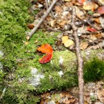
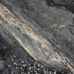
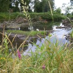
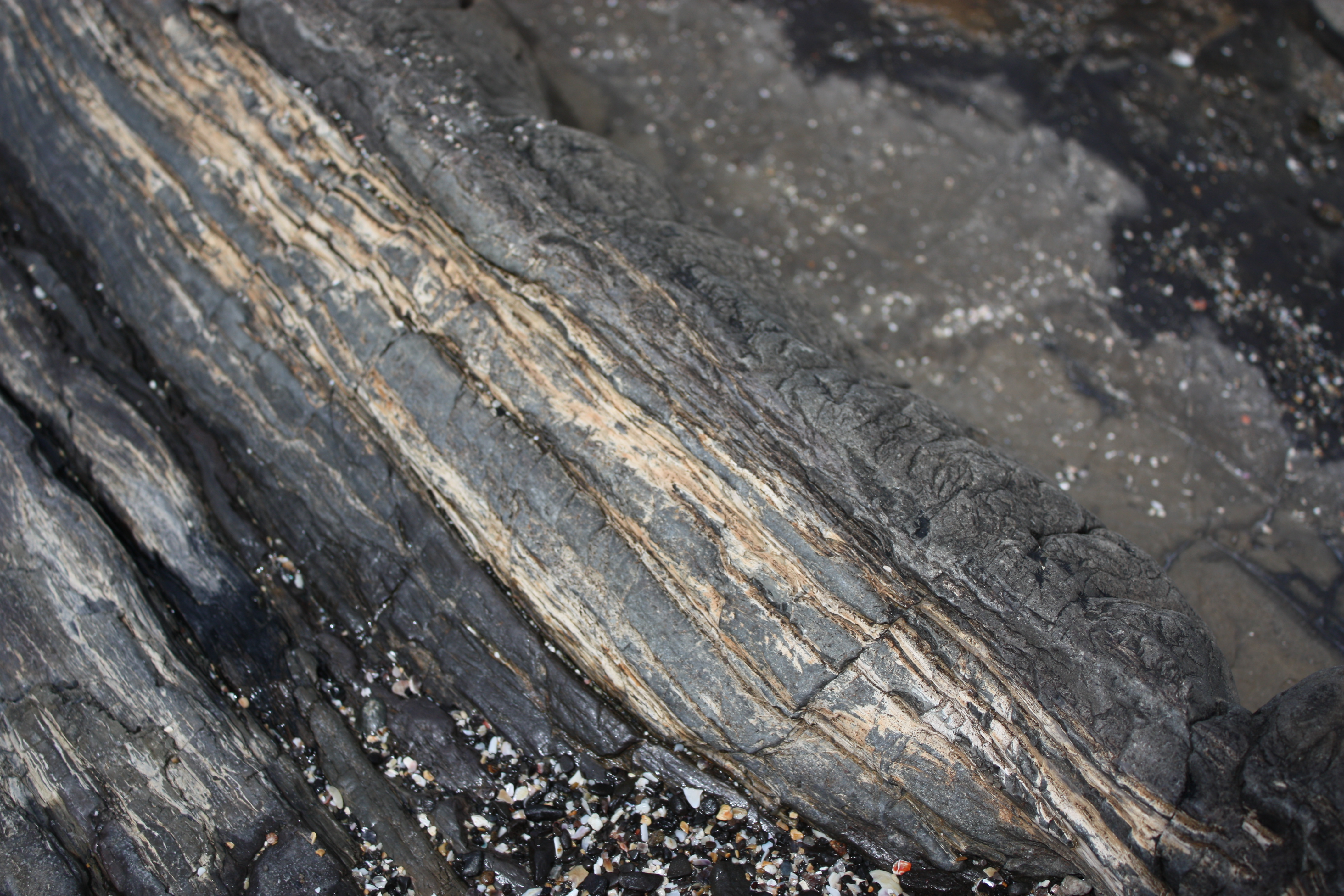
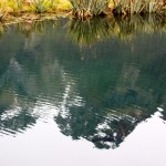
Back in the freedom of our van we drove toward the southeast corner of the South Island, to the Catlins area. Along a river we saw many little houses, tiny, some that had been in families for generations. People stay there when they are white-fish netting and the buildings are a regulated size. At Curio Bay one may see yellow-eyed penguins but we didn’t see any when we stopped there. A large area of exposed rock along the beach included petrified wood. Eons ago this was a lush tropical forest. Volcanic eruptions produced silicates that preserved the wood. Today this is considered an “extensive wave platform.”
It was cold and windy and hail pelted us as we came back up the stairs from the beach. Flax grew in dense thickets along the top of the bluffs. As we headed toward a shelter to eat lunch we passed by a sea lion— way up there! It had its head hidden in some shrubs but entire body exposed, probably thinking if it couldn’t see us no one could see it. After lunch we drove another long distance going past the Catlins Coastal Rain Forest Park. A truck loaded with bales of wool went past us.
We took a short coffee break at Owaka “place of the canoe”, a little town just after a lake where we had seen many black swans and a couple of spoonbills. Along the main street in Owaka was a teapot collection decorating someone’s yard, which added a bit of whimsy.
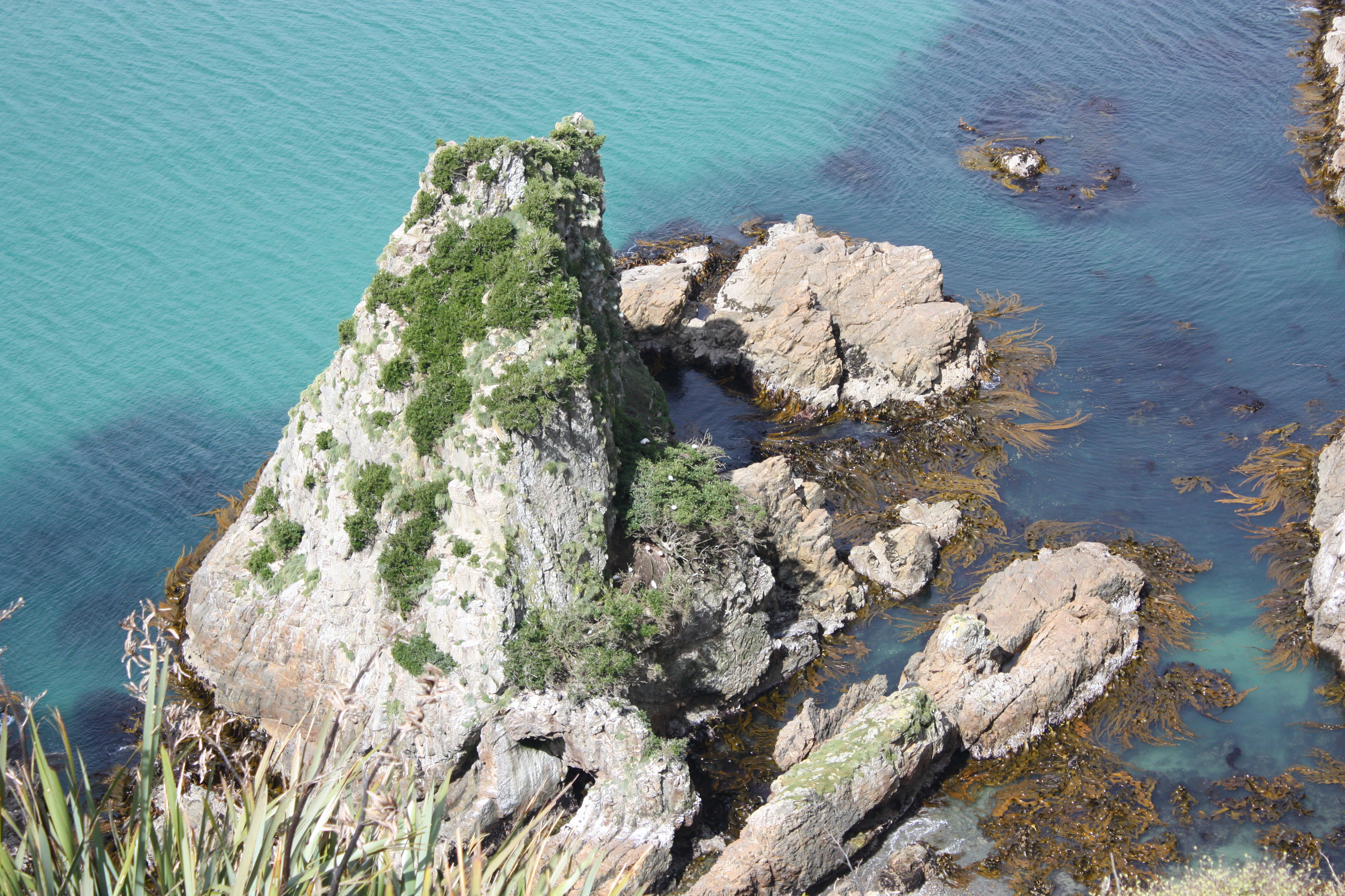
Another s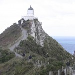 ide trip in this area included hiking up to Nugget Point Lighthouse where we could see New Zealand Fur Seals and an occasional albatross. The Nuggets are a series of nearby rocky islet
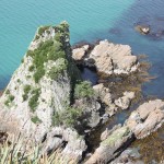 s. The lighthouse is out on a rugged point where the waves break dramatically, coming from two directions. Two different kinds of seaweed were evident here as well.
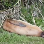
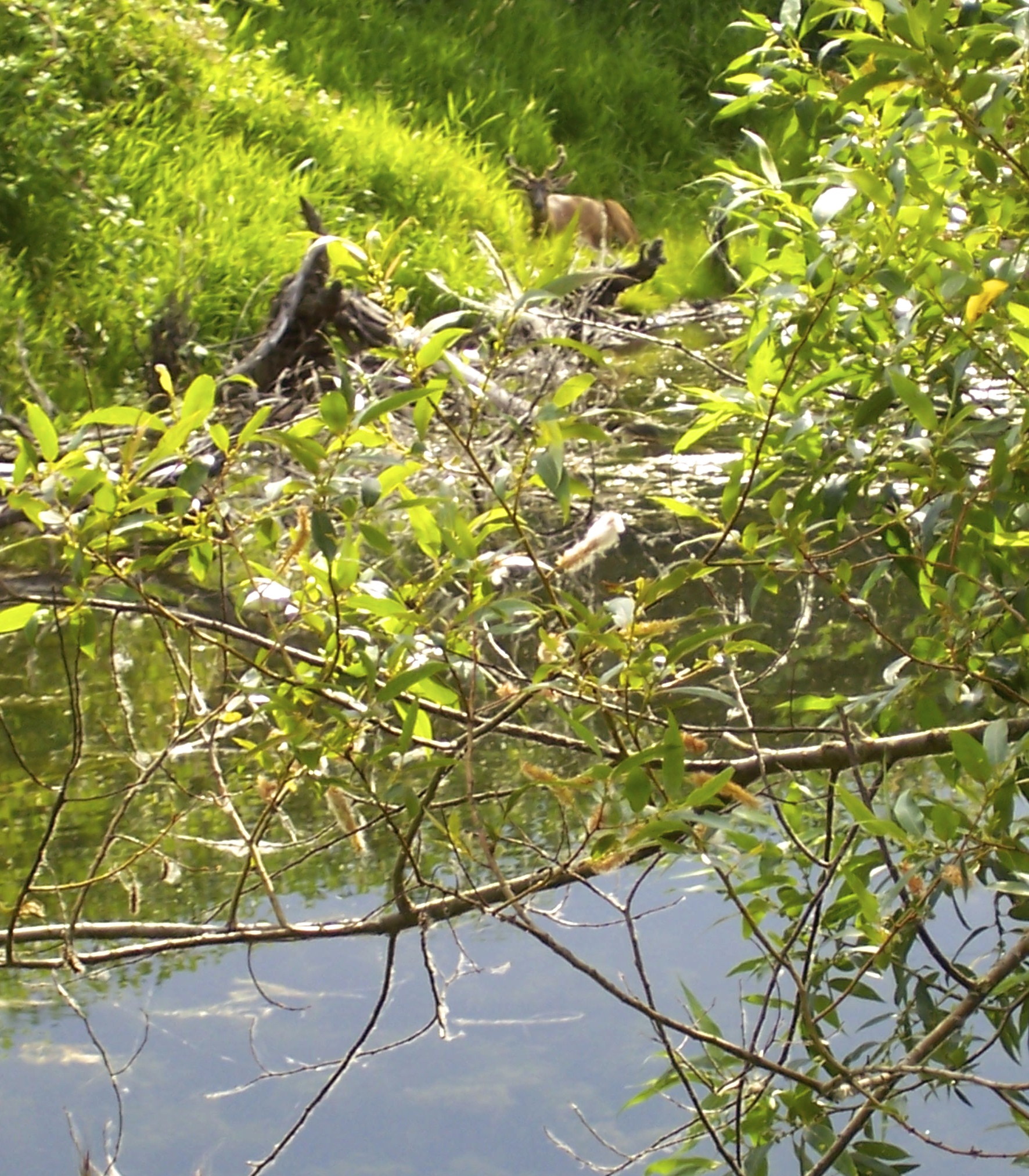
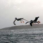
Our final stop, before going to the Cargill Hotel in Dunedin, was at Cannibal Bay where we got close to some New Zealand sea lions, probably the world’s rarest sea lion. They are very large and one is warned to not get too close because they can move rapidly when annoyed, up to 20 miles per hour. Tom got a little closer to one (pictured) than perhaps he should have and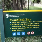
it reared up from its prone position to look directly at him while both Derek and I were yelling, “Tom get back!” He did back up and the seal lion relaxed. Whew!
At the Cargill Hotel, room 115 was our landing spot for the night. Rooms were around a nice courtyard filled with flowers. At dinner we were able to enjoy, those f us who love them, bagpipes played by a kilted bagpiper, who was accompanied by ano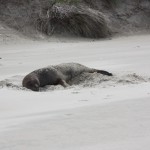 ther bearded and kilt-clad fellow, playing for a group celebrating a haggis. Haggis is a Scottish dish (containing meats, spices and oatmeal) celebrated by Robert Burns in his Address to a Haggis, and a celebration includes Scotch whiskey and recitation of Burns’ poetry. Cultural events are often celebrated with a haggis. In the olden days the meat included the cleaned stomach of a sheep stuffed with the other ingredients before cooking!
So here in Dunedin we celebrated Thanksgiving with some of us having salmon for dinner. A small piece of cake with a candle on it was brought out for Derek, and words of praise spoken, to thank him for the good time we had all had on this trip.
At 9:00 p.m. a fire alarm went off and a voice told us to evacuate. Tom wasn’t in the room and I had just read a description beside the alarm on the wall that instructed inhabitants to push a button beside the now blinking light if your shower had been steamy or you’d forgotten there was no smoking in the room—that button would shut the alarm off. I had done neither the steam nor the smoke but kept pushing the button before deciding it must be an overall alarm and exiting the room. I joined the other denizens of the hotel in the dark in front—some of our group in pajamas, some who had simply thrown on a robe as they’d been about to get in the shower, some still in street clothes. There was much milling about, talking and laughing, along with an undertone of worry as a fire engine pulled up making the situation a bit more serious. It was a false alarm though as someone, not one of us, had let a bathroom area get too steamy and the alarm had gone off. That was the story anyway.
Before the fire alarm, Tom and I realized we had the wrong information for our flight home and with Genny’s help, Tom figured out that we needed to leave for the airport at the same time as everyone else the next morning. Otherwise we would have missed our flight!
At breakfast, Genny asked Derek whether this had been his most exciting trip that he had led and he acknowledged that it probably had been: attacked by a falcon, the narrow escape on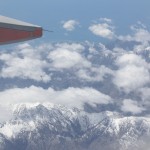 the airplane, and the fire alarm. He may possibly have thought to himself “and all of you Americans”.
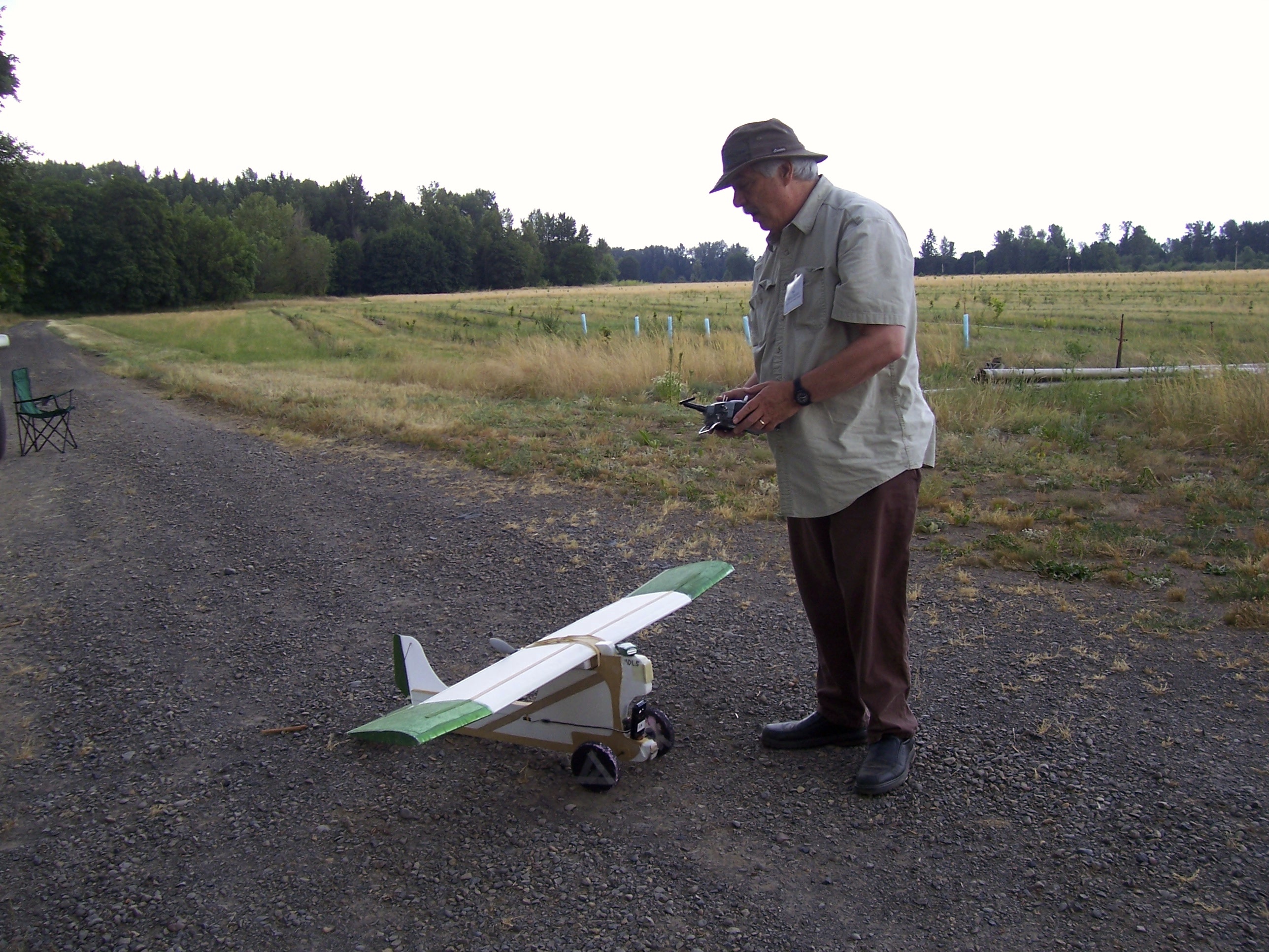
At the airport, two couples left on one airline, we were on another and the guides on yet another although heading for different destinations. Our flight to Auckland was delayed an hour. Once aboard the plane we discovered that the girl sitting next to Tom was a hocky player flying north to play a game that weekend. She helped me put my carryon bag in the overhead before Tom got there. She told us that after high school she might like to go to Canada and wanted to study physical therapy. The flight north was quite lovely- we were above solid clouds for quite a while but when flying lower could see islands, bays, a long edge of coast and snowy mountains. We had made reservations for two nights in Auckland to have some free time before flying home.
To be continued


 out things on our own. Fortunately we had spent a couple of days in the Auckland area before the trip started so knew our way around.
 he streets afterwards but there weren’t enough places provided to dispose of trash.
 a little strip of land. There used to be three small volcanic cones forming the island but the top was taken off one of them to create fill. Half of the fill is a golf course now.
 historic district. Devonport was established as a boat-building community and also had a number of masons. The town has a naval museum. Some of the buildings on the north facing slopes are worth millions. The climate is mild. People open windows for cooling sea breezes. Buildings are painted every 15-20 years. Children learn to sail as part of elementary school classes in Devonport and there are four elementary schools serving children 5-10 years of age.
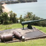 was expected to take for the ship’s arrival. A
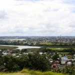 t least one of the canons was the kind that is located in a hole and then raised up to be used. We went up on the fortification hill, Mt. Victoria—where underground structures, a bunker etc. date from the Russian Scare time.
 ts for the water reservoir located in the original crater of this little volcano. The Signalman’s quarters is used for writing workshops.
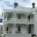 Big Bay contains 47 islands. Ships coming in need pilot boats because the passage is narrow. The Royal New Zealand Navy has a base here. Devonport is like a suburb of Auckland
 l information that I have looked up appears in italics.
 few of his stories. The sun came out right at the time we saw crested penguins along the shore, four of them standing on the rocks. Then clouds would come in and then sunlight again. We had mostly good weather the whole day, although windy. I wore long underwear, my new pants and rain pants over those. On top I had a long-sleeved shirt, a sweater, my fleece jacket and Tom’s rain jacket (because mine leaked).
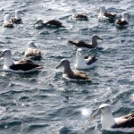 we were further out, the captain tossed cod overboard and the albatrosses came swarming: white tops, Salvin’s (gray neck and head), Southern Royal and Northern Royal; a skua, white-fronted terns, red-billed gulls, and more. We saw a few fur seals up on the rocks and pulled into one cove where shags were nesting in the trees along the shore.
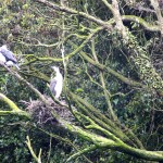
 a history of Maori living here. Maori used to come to the island to strip the bark from the totara trees to use for storing mutton birds (sooty shearwaters). Kakas also will strip bark from the totara looking for grubs and sap. It is believed that some of the Maori activity occurred 100-200 years ago. A post office was established here at Post Office Bay and a flag raised when the mail was delivered so that scattered settlers could come from other areas along the inlet to get their mail.
 . These box lunches were big: a sandwich, fruit, nuts, brownie, juice, etc. There was a cylindrical outhouse just behind the shelter—no toilet paper but painted a cheerful, bright, sunny yellow inside and green outside.
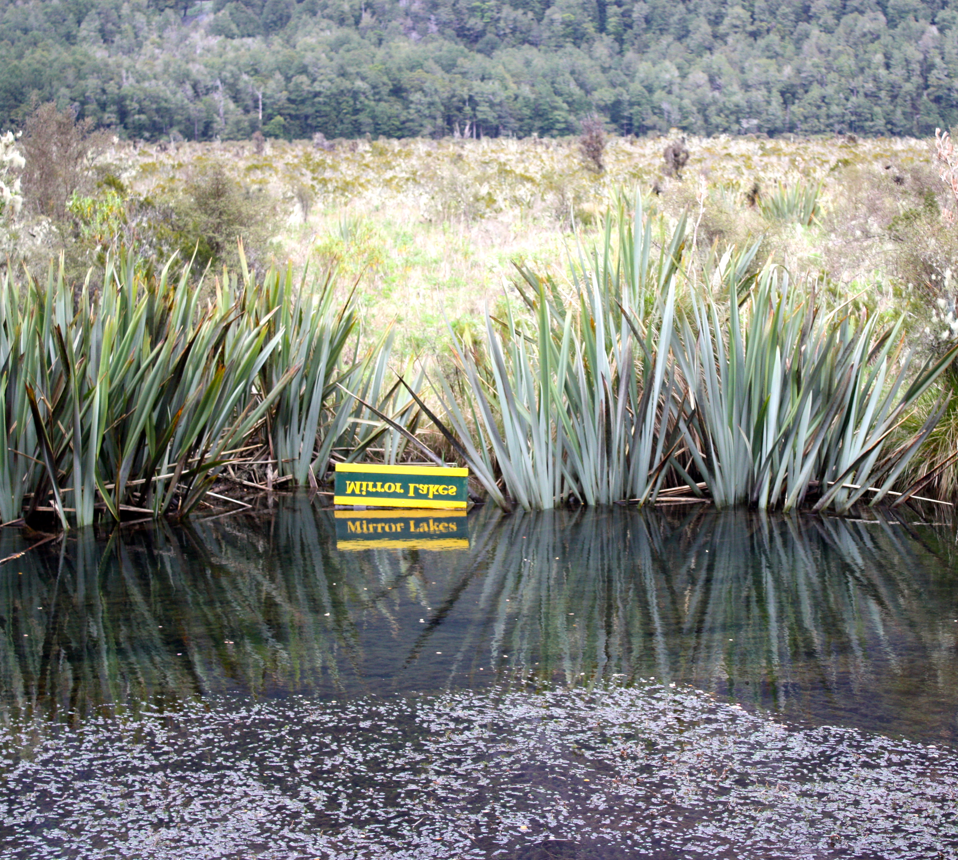
 Things are drawing to a close. Tomorrow we take the ferry boat back to the mainland and then drive to Dunedan. Sometimes on a day I’ve been ready to go home but always something interesting has happened and I’ve been glad I was here.
 hat existed in that brief moment of potential death was the wing of the plane—in brilliant detail–and a foot or so below the tip of the wing, the intense greenness of the trees. Not my whole life flashing before my eyes, not the plane, not my fellow passengers, not the buffeting wind or the rain, just the sharply outlined wing and the trees, like a still shot inserted into the middle of a movie.
 we saw a male merganser on a lake and a blue duck in an enclosure. Other birds that could be seen here included the Morepork Owl, a bit difficult to see in its shelter but nice to see an example of the only surviving owl species in New Zealand. It is also sometimes called the Tasmanian spotted owl. This small owl eats insects, small rodents and birds and hunts in the forests. Apparently barn owls have migrated to New Zealand from Australia but they are not a forest hunter. The name Morepork comes from the sound of its call.
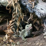 d-raised in outdoor enclosures. “They were once found all over New Zealand but now are found only on 32 offshore islands. They are the only surviving members of the order Sphenodontia, which was well represented by many species during the age of the dinosaurs, some 200 million years ago. All species except for the tuatara declined and eventually became extinct about 60 million years ago.” (Department of Conservation online publication). The creatures are successfully breeding and one (Henry) is believed to be 100 years old. Other exhibits here include Maori culture, birds, and an art gallery.
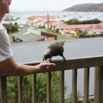 ent on Stewart Island (the third largest island in New Zealand) and is a fishing village. Our room had a wonderful view of Halfmoon Bay and there was a long balcony running clear across the front units.
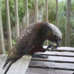 y we realized we were being watched. Kakas! These large parrots, closely related to the Kea, but more arboreal, were looking in our window and asking to be fed. You are not supposed to feed them but it’s hard to resist, particularly for people like us who wanted pictures. Tom got some nuts out and when we looked down the balcony we could see Shane and Genny also feeding them and taking pictures. At one time five of these birds were jockeying for a good spot. Eventually we had to close the curtains so they would think no one was home. They have a spoon shaped, bristly edged tongue useful for lapping up honeydew or nectar from flowers of flax and rata. They also remove strips of bark to get sap. Kakas are primarily a cavity nesting bird and vulnerable to predation by possums and stoats. Attempts are being made to control these predators in the Halfmoon Bay area through use of fences. The Kaka’s name can also be pronounced as “kaykay” rather than “kahkah”.
 hotos, had some hot tea, and then it was time to walk to dinner.
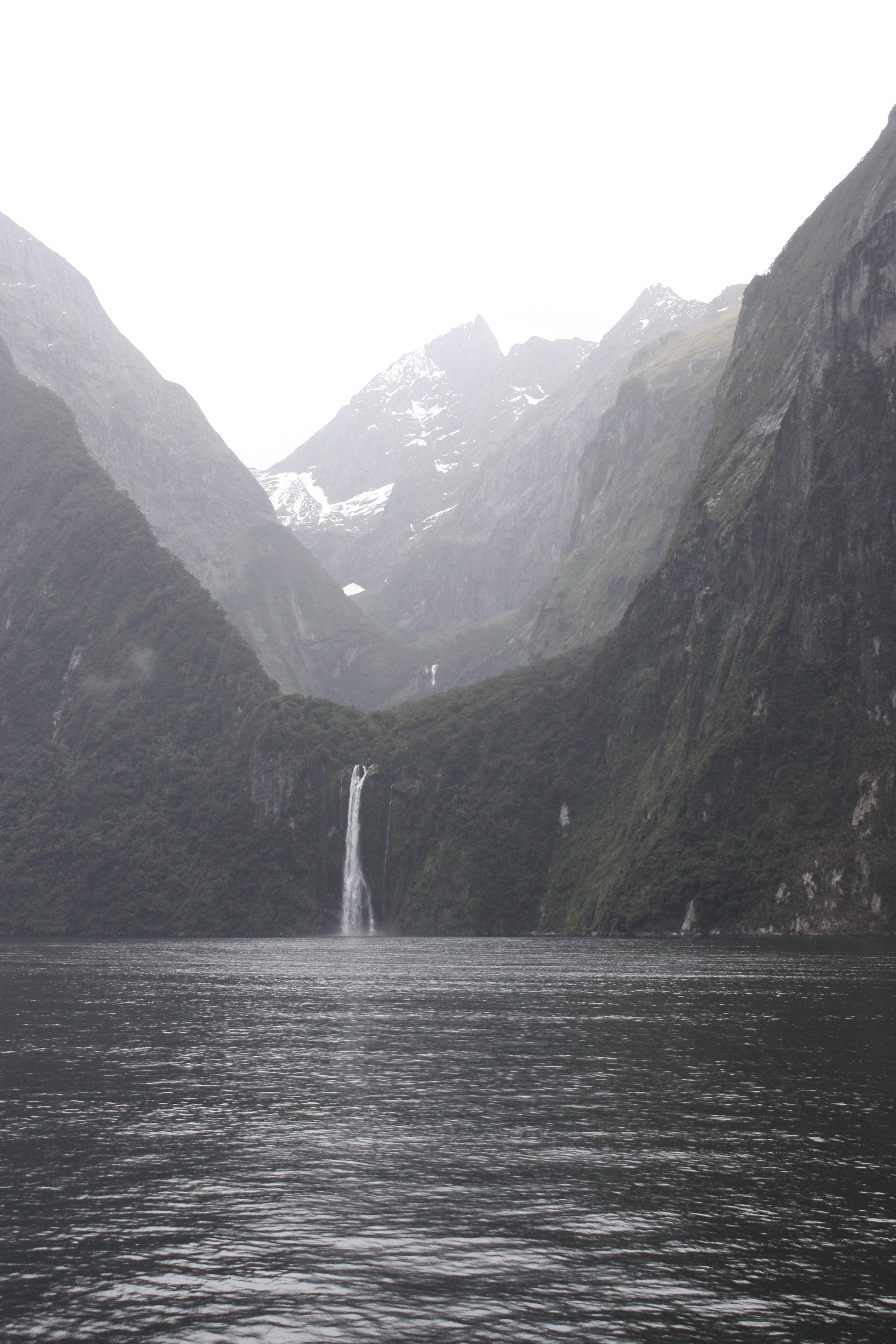
 the wettest inhabited places in the world and the wettest in New Zealand. This means, of course, th
 at the excited tourists with cameras—us—can also be taking photos of a much more mystical nature although no less beautiful.
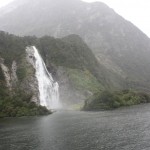 nalities on board and a few couples who were very smoochy, honeymooners maybe. Rain, wind and spray from waterfalls doesn’t strike romance to most of our hearts I think so that was my explanation for their closeness. That and perhaps a desire to stay warm and maybe let the other person block the spray! I stayed out on the upper deck nearly the entire time, going inside for about 10 minutes toward the end as I was getting wet and cold and really craved a cup of hot tea. Tom was already there. Once I’d warmed up for a few minutes I went back out but stayed under an overhang on the deck where it wasn’t so wet.
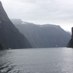 animals normally found at greater depths may be near the surface. The soil, where it exis
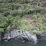 ts, is very thin and only 20% of the trees are actually in soil. If a solid tree loosens it can take down a whole batch with their intertwined roots—almost like an avalanche, leaving a bare, rock slope. It can take hundreds of years before the patch of forest is re-established. We could see several places with a cluster of trees at the bottom of a long, barren slope. The predominate tree is beech.
 ger and there was more wind. I was glad I’d taken anti-nausea pills that morning! Wonderful to be on the top deck with wind carrying the rain into your face as you balance with the swells. Over to the left, before we turned around, we could see a lighthouse well above sea level that we were told has had waves hitting it during big storms.
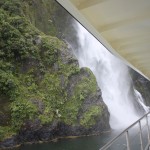 was torn between trying to keep my camera dry and snapping just one more photo. We were out about two hours.
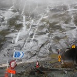 y back down the highway we stopped at the Gorge parking lot (where the Kea were) and some of us walked in the pouring rain to a place where water has ground huge potholes by swirling boulders against the rocks—it was very loud with the sound of the rushing stream. I got soaked despite my rain gear. Later, when we got to the other side of the tunnel, some, including Tom, went looking for rock wrens in the rain. Taryn, Genny and I stayed in the van. They were gone at least 20 minutes. Taryn fed two more keas bits of apple. They didn’t find any wrens on their excursion. Note the patches of snow and waterfalls next to the tunnel.
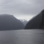
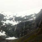 t, then raining off and on and then RAINING. Milford Sound day.
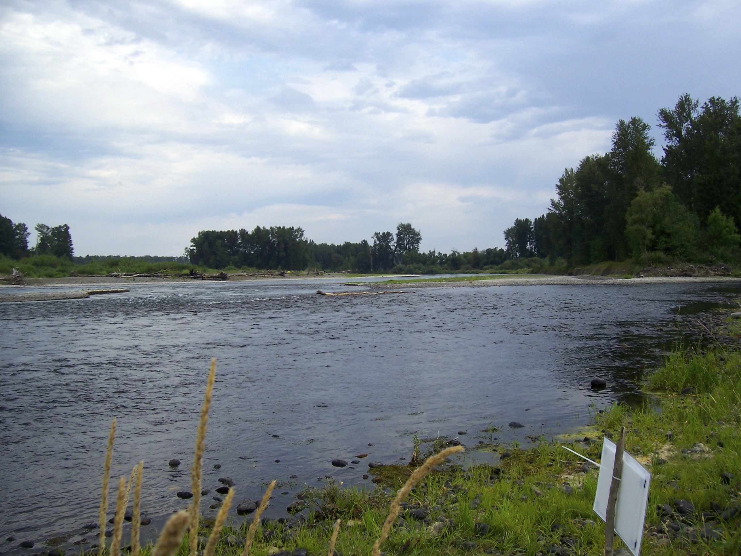
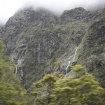 e Eglinton River, which runs into Lake Te Anau on the east side. This is one of the few valleys in Fiordland National Park with road access. The forests are mostly beech.
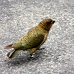 s and some cars were parked and people were takin
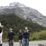 g pictures of Keas, very large mountain parrots. Two, quite tame, were eating bread or fruit. They call “kea” when flying from one valley to another. This is the only true alpine parrot in the world and is native only to the South Island. They are a highly intelligent, very social and adaptable creature. Keas are omnivorous and have, at times, been seen slitting
 open the backs of sheep and eating the sheep’s fat. The birds nest on the ground in burrows among tree roots. For many years there was a bounty on them because of the sheep attacks but populations plummeted and today they are a protected species, although killings of the birds still occur.
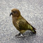
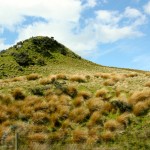 d they were red tussock grass. Sheep don’t like this when it’s large so non-native grasses have been planted throughout New Zealand for the benefit of the sheep. But they are trying to create a preserve where the grass, which gets two-to-three feet high, can grow naturally. We later saw a motel in a town that was called the Red Tussock Motel and was painted almost the same color.
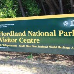
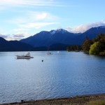 Then we headed toward Te Anau and Milford Sound. We stopped that night at the Kingsgate Hotel right next to Te Anau Lake. The lake’s name was originally Te-Anau-au, Maroi for “The Cave of Swirling Water.” Three large fiords form arms to the lake, the only inland fiords in New Zealand. Several rivers flow into it and one, the Waiau, flows out. Most of the lake is within Fiordland National Park. One point of interest here that we didn’t see was the G
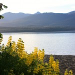 lowworm Caves, which are accessed by taking a boat across the lake. These limestone caves have waterfalls and rivers and one area has cave walls covered with glowworms. Several hiking tracks begin here at the lake.
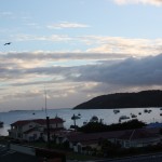
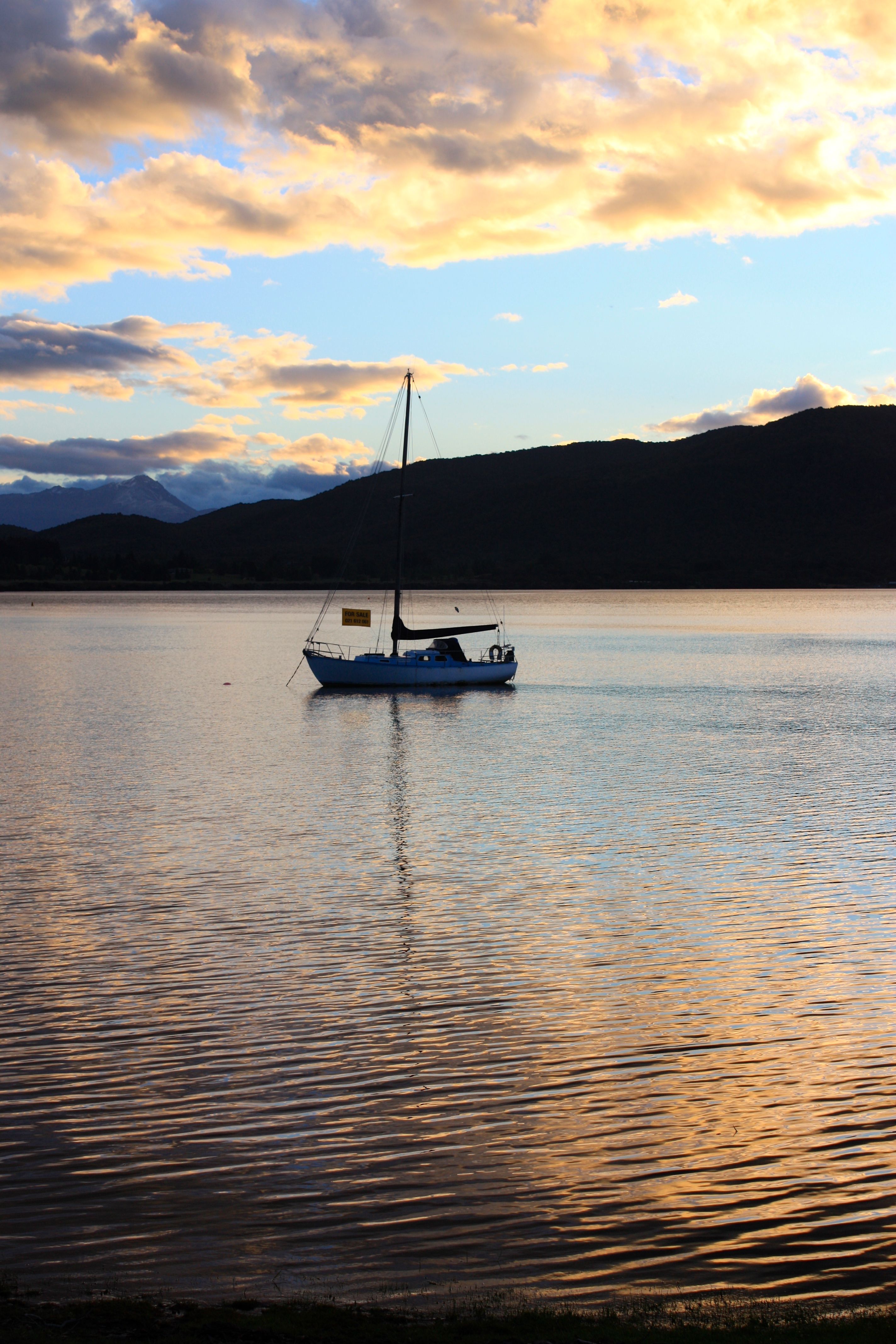
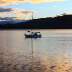 course there were Tui, which we saw frequently on our trip. They’re about the size of our robin, dark with white throat puffs, and have a variety of songs. A small float plane rested on the lake and a couple of sailboats. During dinner we had seen five or six little sailboats from our table, a couple of them having red or blue sails. There was a beautiful sunset and it was hard to stop taking pictures.
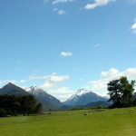 After leaving Arrowtown and going through Queenstown we drove along Lake Wakatipu, a finger lake formed 15,000 years ago by retreating glaciers. The lake is very narrow, long (84 km-52 miles), and deep (339 meters—1,112 feet) with mountains rising straight up from its edges. So dramatically lovely. We stopped several times along the highway to take photos. Maori legends say the lake was a giant, Matau, who burned to death in his sleep after abducting the daughter of a chief. The heat from the flames burned a hole in the rocks and melted ice and snow, which filled the lake. The level of the lake fluctuates five inches every 25 minutes and the legend says that the heart of the giant, which can never be destroyed is the small island (Hidden Island) and still beating. Scientists say the fluctuations are caused by atmospheric conditions.
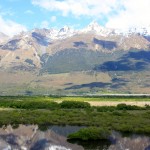
 Our pathway was across a swaying suspension bridge over the small Dart River and into a red beech forest. This beech is native to New Zealand. In years when the trees produce bumper crops of seeds, rat and mouse populations explode. This, in turn, creates a large population of stoats, which prey upon the rodents. When the rodent population drops after this population burst then the stoats prey on native birds and their eggs, including the kiwi, as well as upon bats and snails. Stoats are invasive members of the weasel family and were originally i
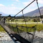 ntroduced to control rabbits and hares.
 the populations of these species. We did see several of the Australian robins (which are black and white) and a yellow hammer.
 . Suddenly the rest of us saw a large bird swoop down and fly just above his head, disappearing into the trees on the other side. Derek, who hadn’t seen it coming, turned and told us we should look out, he’d just been attacked. We laughed. After crossing the bridge into the sunlit parking lot we realized that yes, indeed, he had been attacked. The New Zealand Falcon had drawn blood, going through his head of thick curly hair to the scalp. It must have had a
  nest nearby. Taryn got out the first aide kit, put antiseptic on the wound and we were soon on our way again.