New Zealand, Part 3

Posted by Susy in Uncategorized | Comments Off on New Zealand, Part 3
IMG_1390.jpg--sailboats, typical scene

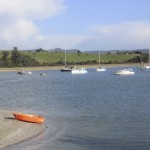
Typical scene near coastal village

We were still north of Auckland and had explored a bit on one side of the narrow stretch of land between the Hauraki Gjulf and the other side toward the Tasman Sea.

Today we were going on a half-day trip out into the Hauraki Gulf. Yesterday we observed nesting gannets from bluffs above the Hauraki Gulf.

IMG_1410.jpg-nice photo, birds & town, N.J.

View from the Norma Jean

The name of the small charter boat that was to take us on this day’s adventure was The Norma Jean. Yes, that Norma Jean. And our captain was quite a character. He was 69, he told me. He was medium height and stocky, had a short beard, tattoos, and wore brown clogs, a T-shirt, and shorts. When the wind got chilly he’d put on a pullover sweater. He was cheerful and chatty, pointing out things of interest as we traveled. Another man helped him with the boat when he needed to be out on the deck or had other things to do.

Most of the time I rode inside with the captain although sometimes I’d go out on the back platform where most rode and sometimes on the narrow sides. He asked me how old I was and when I told him my 76th birthday would be in December he was delighted to learn we were both Sagittarians. His birthday, he told me, was the 14th and he said his mother had given birth to him when she was 47. He showed me the scar on his knee from knee replacement surgery and said he wants the other one done as well. The captain mows lawns as part of his way of making a living and told me he had two sons one of whom is 6’4” tall who plays basketball. He had photos of himself on the wall from when he used to fly helicopters. No one is what they seem at first glance and those I met in New Zealand were rich in their life experiences.

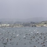
In addition to socializing on this day I also saw, as did the rest of our group: blue penguins in the water, gannets, shags perched in trees along a bay where the water was calm and there was almost no wind, white-fronted terns and others.

At one point we were offered hot chocolate (water was brought to a boil on a 2-burner stove} and cookies! Unfortunately my notes don’t show what we did after returning to the dock. Some days it was really good that I wrote things down. It’s hard to digest everything that takes place and remember which day an event occurred.

The following morning (November 14) we were up early, leaving at 6:00 a.m., and stopping in a little town for coffee to go–$6 for a decaf mocha. The owner of the coffee shop was from Santa Barbara and was happy to talk to our couple from that city. In addition to a home in New Zealand he owned a condo in California. We drove through a small town that did a great job with their seashore area, making a long park with green lawns and playground equipment between the bay and the highway. Shoreline property in New Zealand is government owned. It was a lovely day with the sun slanting through the trees and sparkling on the water.

We went first to a wetlands visitor center (Miranda Trust Shorebird Centre) to view the migration pattern of the Godwit. It goes from Alaska to China and back to Alaska by different routes. Its habitat is disappearing in China. The Godwit’s migratory flight is the longest non-stop flight that’s known.

We are used to seeing birds that have bills that curve downward (such as some sandpipers) and upward (avocets) but on this day we saw some whose beaks curve to one side. The wrybill, a small plover found only in New Zealand and whose population is about 5,000, sports a bill that curves to the right and is believed to have become that way through years of prying food out of glacial gravel. Today this is an advantage on mudflats (tidal flats).
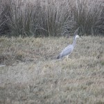
IMG_1444.jpg---white-faced heron, good

White-faced Heron

For some time we drove through miles of countryside where everything was green: grass, shrubs, trees and lovely, rolling hills. Some of the hillsides looked as if sheep and cattle had overgrazed and there were soil slumps. In other places stream banks appeared damaged by erosion. We were treated to seeing a wave of sheep running down a hillside, like sea foam across the green slopes, with a sheep dog right at their heels. We pulled over for a few minutes to watch. One lamb was left behind but we felt better when we saw the rancher on his little tractor coming down the hill, towing a trailer to help any such forlorn stragglers. Some of the water containers in the fields- concrete, round structures- open at the top—had basketballs in them. When Tom pointed this out he said that this way the rancher can drive or walk by and, from a distance, discern whether or not water needs to be added.

IMG_1455.jpg--more fern tree

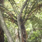
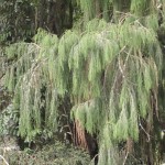
Close-up of a fern tree

Later we walked in Pureora Forest in an area that was heavily logged by their Forest Service. Enough old growth remains to be able to see what it used to look like though. Podocarps are conifers that date “back to the time when New Zealand was part of the super continent of Gondwana” . (New Zealand Dep. of Conservation). A local person became an activist and was involved in stopping the logging, leading the way to save them. Podocarp forests, similar to rainforests, often contain a dense growth of understory trees and this area supported many of the big tree ferns as well as broad-leafed trees. There was a 12 -meter high tower right by one of the large trees and most of us climbed the steep stairs for a better view of the forest and the towering rimu tree.

IMG_1459.jpg--foliage of the rimu tree

Foliage of remu tree

That night we stopped at Creel Lodge, located at the southern end of Lake Taupo along the Tongariro River. This river is apparently one of the best places to fish in New Zealand. And the motel was another welcoming place to stay, surrounded by shrubs and flowers. We would be here two nights.

A bit of trivia: I saw a road sign that said “papa toe toc”.

Pedestrians don’t have much clout in New Zealand and instead of having “Yield” signs aimed at pedestrians they say “Give Way”.

We drove through the Sheep Shearing Capital of the World.

A sign on a van said “Nos petit Maison” (Our Little House).

We drove past a sign saying Whakapapa National Park, an area with thermal pools and steam vents. Much of New Zealand has been or is volcanic, particularly the North Island.

to be continued

New Zealand, Part 2

Posted by Susy in Uncategorized | Comments Off on New Zealand, Part 2

A sewageIMG_1268.Black Swansjpg 
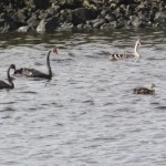
treatment pond? Really? But look at the Black Swans! This was our bird-watching tour’s first stop and offered some unexpected sightings, at least for me.

After meeting and greeting and loading our luggage into the van and picking seats we had set out on our first spotting trip under the our guide Derek’s supervision. He was also the driver in our explorations on New Zealand’s North Island.

Black swans have been introduced to the North Island from Australia and some have actually flown here. They are a large, black bird with a red bill and white flight feathers although floating gracefully on this pond the white feathers didn’t show. There were other birds here as well and I got a reasonably good photo of a Pied Stilt, a black and white bird with long legs. We were welcomed by the Welcome Swallow, New Zealand’s only swallow, which we would see frequently throughout our trip.

There were seven of us on the tour ranging in age from early 60s to somewhere around the early 80s. One couple was from Santa Barbara, California where both were marine biologists, retired. Another couple was from Indiana. He was retired as a sociology professor at Perdue and she still working with grant writing. The fifth person was a gentleman from South Carolina who had worked with computer technology of some kind. And our guide had a biology background and great interest in pelagic birds.

From the ponds we rode to the Hauraki Gulf, part of the Tasman Sea, and to Muriwai Beach. Here we were introduced to New Zealand Flax, a large plant with single pointed leaves emerging from the base of the plant and a long flower-stalk with red flowers. The fibrous leaves were used by the Morai for weaving baskets and making cord and rope. Both flowers and leaves were also used for medicinal purposes. When Europeans arrived on the island they found that the flax rope was stronger than the rope they had brought with them.

We walked up a trail about half a mile to an observation platform that allowed us to look off the bluff and down upon a large, guano splashed rock at a nesting site for gannets. Gannets are white with a yellowish head and expert divers and swimmers in their pursuit of fish. They can reach a speed of 62-miles per hour in their dives.

While looking at gannets we noticed a rescue training going on with people in the water jumping from a low rock ledge into the very strong waves and ocean currents. A small boat circled about in case it was needed but the trainees appeared to be strong swimmers and able to swim withoutIMG_1295.--good shot nesting gannets at Hauraki Muriwai Beach jpg 
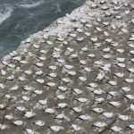
assistance. This training continued for the entire time we were there. The cold and the forceful wind made our van seem quite cozy when we returned to it. From there we drove a short distance to the Sand Dunz Café for sandwiches, which we ate sitting at a table outside. Being a short distance away from the sea the wind was more tolerable.

Our next stop was Waipu Estuary where we were fortunate enough to see a rare Fairy Tern, among other birds, and then headed back to our motel, The Salty Dog Inn and ate dinner that night at a nearby café.

By this time I had a chest cold and my notes say, “I hope I haven’t infected others” but of course I had and most eventually came down with it it. Sometimes we sounded like an infirmary as we traveled.

The next day, after a big breakfast, we took a ferryboat to Tiritiri Island. All the ferryboats that we used during our stay in New Zealand were people boats, no cars.

Tiritiri Island was heavily grazed by sheep and cattle in the early 1900s. Rehabilitation started and all the trees, shrubs and other plants we saw were planted by hand. An amazing diversity of plans and bird life had flourished. Because of New Zealand’s problems with invasive species, both plant and animal, we had to wipe our shoes/boots on brushes when leaving the boat as well as when about to step onto the island. School children had also come on the ferry for a field trip and we waited until they had dispersed before heading up a different trail.

One of the birds we saw on Tiritiri was the Tui. It’s a common bird with a variety of melodious songs as well as buzzy noises and has white neck patches on its otherwise black body (although in sunlight may look iridescent). There were robins –New Zealand’s robins are smaller than ours and black with a white breast. We saw honey eaters, a whitehead, stitch birds (very pretty with a lot of yellow on them), a green parrot in the top of a palm tree eating flowers, and very large Australian pigeons, larger than crows. The photo to left is an oyster catcher. IMG_1319.-oyster catcher, goodjpg

After using our binoculars through the woods we emerged on top of the hill where there was a lighthouse and a small building where one could buy tea. I ordered a cup of tea but had time to drink only half of it before it was time to go back down the hill to meet the ferry. At the bottom of the hill we huddled together on a bench near the pier and ate our lunches in the wind and rain. But we also were able to see Little Blue Penguins here in rock houses that had been built for them to nest in! There were glass windows in the top so that we could see them. These are the world’s smallest penguins with adults being aout 13 inches tall and weighing about 3.3 pounds.

On the ride back to the motel nearly everyone was asleep. Our days were full with breakfast usually around 7:00 a.m. (either at a restaurant or, if contnental breakfast motel staff would deliver it the night before), loaded up by 8:00 and then stopping briefly to get sandwiches or meat pies for lunch to take with us. Dinner was usually 7:00 p.m. and we’d go over our bird checklist while waiting for our orders, or, if dinner arrived quickly we’d do the lists right afterwards.

All the motels had heating units under the sheets with individual switches on both sides of the bed. Most had microwaves and tea bags as well as instant coffee packets.Many also had kitchenettes (sinks and refrigerators). Cost of meals and motels were part of our tour price. All the ones where we stayed were very clean. New Zealand is very conservation minded and all the motels had separate bins outside for disposal of cardboard, glass, and plastic.


To be continued


New Zealand–Part I

Posted by Susy in Uncategorized | Comments Off on New Zealand–Part I

Ferry Bldg. in Auckland

As the taxi pulled up to our house in the dark, I realized that yes, we were actually going to do this! We were going to New Zealand! This would be my first trip to another country except for a short trip to Cabo a number of years ago and a trip to Canada with family long before that. My husband traveled a lot when he was in the service following high school but this was to be our first trip together to another country.

Our November 2nd trip to New Zealand actually started 53 years ago when I began working at Crater Lake National Park as a Seasonal Ranger-Naturalist. As the only female uniformed staff person that summer I felt as if I had 30 brothers and, among them, three or four became good friends. They teased me as if I were a sibling. We’d take trips to other national parks and take hikes closer to home in our spare time. We all supported each other on the job. Doug was one of those seasonals and, although he wasn’t there my second season, we kept in touch off and on over the years.

Doug and his wife, Gail, and their son Ted run Cheeseman’s Safaris and Doug has often asked us to consider a trip someplace with them. Their own favorite spot is Tanzania while Ted loves Antarctica. Finally, last year, we made the plunge and reserved a place for this year’s trip to New Zealand with one of their trusted coworkers as our guide. This is the only country I’ve really wanted to visit.

We flew from Eugene to Portland to Los Angeles, (where we had a 9-hour layover) to Fiji to Auckland, New Zealand. It was a beautiful flight from Portland south. We were above the clouds for a while and then decided, when we saw lakes with dry shorelines, we were over drought-stricken California. Lake Tahoe was recognizable near mountains with a skim of snow. Then suddenly the clouds opened up and there was Yosemite and Half Dome! What a treat!

It was after 9:00 o’clock when we started the flight to Fiji and I gladly accepted the free glass of wine hoping it would help me sleep. Unlike most airlines these days, Fiji serves food and drink at no extra cost. And in Fiji we were greeted with a song, accompanied by guitars, as we walked into the warm, humid airport.

Our trip was scheduled around birds and mammals of New Zealand and we would be traveling with five other people in a 10-passenger van. When we reached the Auckland Airport we took a shuttle to our motel, about a mile from where our group was to meet. We had made reservations for a couple of days before the trip was to start, and for several days after completion.

When we reached our motel we could hear loud drumming from across the street (“you’re not in Kansas anymore Susy”) and were told it was a group practicing for a Polynesian dance contest that would take place that weekend. The drumming went on for some time but was very faint when our door was closed. Our room had a kitchenette and we were able to get a few things at a couple of very small stores just up the street. Later we found a good store about a mile away and bought more groceries.

To get to downtown Auckland we needed to go to the airport and then take one of their frequent buses, which we did the second day. Some buses tour various parts of the city but we wanted to do a little exploring near the port on Queen Street. The bus we took turned out to have just the two of us as passengers and the driver, of Maori descent, gave us a history of the Maori, the indigenous people of New Zealand, as we traveled, pointing out a small volcano where they had defended themselves from invaders and telling a story about the first Maori to come to the area in ancient times. They are believed to have settled in New Zealand in the 13th century A.D.

Auckland is a city of 1,413,700 people and is on the north island. The Maori settled in the area around 1350 but when firearms were introduced faced many conflicts. By 1864 50% of the populations was Irish, while most other New Zealand cities were predominantly English. In 1961 Maori and Pacific Islanders formed 5% of Auckland’s population but “economic deregulation in the 1980s brought dramatic changes to Auckland’s economy and many companies relocated their head offices (from Wellington on the South Island) to Auckland. Tourism brought 75% of New Zealand’s international visitors through the airport in 2004 and Auckland’s port handled 43% of the New Zealand’s container trade.” Beginning in 1986, more Asian immigrants were allowed and by 2006 the Asian population in Auckland was 18% and 36.2% in the central city. We noticed that in the Eden area there was a wide variety of international restaurants: Chinese, Thai, Korean, Japanese and even a Turkish coffee house. “Auckland is the only city in the world built on a basaltic volcanic field that is still active. “
(all of the information in quotes is from Wikipedia)

In Auckland we walked along some of the streets and took photos of the city. In this part of town the streets were clean and the buildings modern. We took a bus a couple of blocks and then walked up a steep hill to where the Sky Tower reaches high above the rest of the city. Here people can take an elevator to the top, walk around a circular catwalk with a tether attached to the railing, or if they feel extra brave, purchase the privilegeSky Tower, note tiny figure falling1262 
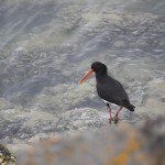
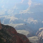
of leaping off the rim and dropping down nearly to the street. We saw a couple of people doing this. They were attached, of course. Many other tourists were wandering about as well and as summer approaches the crowds will thicken. (Note tiny figure on  the right)

Much of New Zealand is designed to cater to visitors and we were impressed with the amount of posted information and the courtesy and help available nearly everywhere we traveled. Whether in the airport or wandering about Auckland, for instance, someone with a yellow vest seemed available any time we had a question or appeared to be baffled.

On November 1, we packed our bags and took a taxi to where our group was meeting.

To be continued….

e

Heading for Home

Posted by Susy in Uncategorized | Comments Off on Heading for Home

Site at Green River

After hiking in Arches National Monument we camped at Green Rivers State Park in Green River, Utah. This was a quiet park, or at least it was for us, and shaded by native cottonwood trees as well as Russian Olive and Tamarisk, both invasive species. We parked not far from the entrance and had no one in any campsites near us. Most seemed to prefer the far end of the campground where there was a larger, more modern restroom. But we had a restroom with showers so were content and enjoyed the lack of nearby neighbors. This park also contained a 9-hole golf course but Tom hadn’t brought clubs on this trip.

We started dinner with a highball (we rarely drink hard liquor but were determined to use the gift we’d received clear back in Southern California). Then salad and chicken “nuggets”, plus potatoes that I “baked” in the microwave. We ate dinner outside at the camp table and had breakfast there in the morning.

Before dark I walked across the campground to the far side where there were a coule of campers with tents. We thought they were probably river rafters. A bog with cattails was on that side and a trail went across to a large group campsite although it appeared to be empty. Always during the daylight hours there was the sound of doves. And we saw nighthawks swooping through the gathering darkness.

We could see lightning in the distance but after we went to bed it got much closer and the rain poured down. It was nice to hear it tapping on the trailer. Before the rain started we ran the air conditioner for a while to cool the interior of the trailer.

From here on it seemed as if the trip was beginning to end even though we had miles to go, and people to see. From Green River we went over a pass and down into Wellington on Highway 191. Chalky cliffs looked bright against the dark grey clouds. We began noticing many small cars, some with an insignia, coming toward us.

Wellington, with a population of about 2,000, was settled in 1896 by a band of 13 Mormons and here we saw a large Mormon church—although I think I’ve never seen a small one. We stopped for lunch at the Outlaw Café. And it was here that we discovered the story of the many small cars that we kept seeing. A couple driving a Mini-Cooper were meeting friends there for lunch and they told us they were part of a group that was traveling from San Francisco to Boston in a rally. They said everyone stayed in the same town at night and left together in the morning but the rest of the day was up to the individual drivers. They wore T-shirts with the list of days and locations on the back. They were going 5,000 miles and through 18 states. This restaurant had a swimming pool accessed from the back of the restaurant as well as from the adjacent motel. While typing this I just noticed on a map that Highway 191/U.S.6 is also called The Grand Army of the Republic after a Union Civil War organization.

As we began to leave the valley we noticed oil tankers on a train that was parked along a siding and a coal powered power plant on a turn of the highway, with massive amounts of steam rising. The railroad tracks were double tracks leading into double tunnels near the Price River whose headwaters are in the Jim Bridger Teton National Forest of Wyoming. The Price eventually empties into the Green River. Up on the slopes aspen were mixed with conifers and I saw a beaver dam to our right. We were in Wasatch County now and crossing Soldier Summit, elevation 7, 477 feet. In the fall that left slope of aspen would be solid yellow. A group of soldiers stationed at the summit in 1861 was caught in a July snowstorm. Two of them died. Hence the name. This is the highest point in the Denver and Rio Grande railway.

Near Snowville we stopped at a rest stop. Snowville, elevation 4, 455 feet has a population of less than 200. It was settled in 1878 under the direction of Brigham Young. In the restroom I spoke to a young woman who was also washing her hands. She was from Corvallis, Oregon, a 45-minute drive from Eugene! What a surprise that was for both of us—we felt as if we were neighbors. She and her husband were also on their way home. I’d noticed him outside looking through binoculars at the junipers. There was a sign at the edge of the parking lot with information about Ferruginous Hawks (our largest hawk) nesting in the area. As they left the parking lot we were waving to each other. Funny….

Our next notable inhabited area was Salt Lake City—heavy traffic, lots of churcheNear Salt Lake Citys with tall spires, beautiful mountains in the background.

Our last “camp” site was in Rupert, Idaho and called the Village of Trees RV Park. Rupert has a population of about 5,500. Rupert was founded in 1906 and, because of the construction of Minidoka Dam on the Snake River, was one of the first towns in the U.S. to light its streets using electricity. Rupert is home to a large cheese company (making Swiss cheese) as well as a potato processing plant. It was about 7:30 when we arrived and 9:00 by the time we ate dinner—and dark. It was very windy and a bit chilly and depressing. The Village of Trees was a valid name for this RV park as there were a lot of trees. We were close to restrooms and no one was in the two sites between us and the facilities. I used water from a tall pump near one of the other sites rather than our little short one. I’m always uncomfortable using a short faucet that seems too close to the sewage hookup.

I liked the place better in the morning. It was quiet and we could see horses in a field between the RV site and the river. I thought I saw a white pelican cruise by. I walked the short distance to the office (grill, convenience store) and bought a cup of coffee for each of us and a small sweet roll to share. We had hard-boiled eggs, left over hash- browns, and orange juice.

Then we were on the road again. We drove past Hagerman Fossil Beds National Monument and fields of corn and wheat. Our next stop was in Boise, the capital of Idaho, where we maneuvered the trailer downtown to park near the Cottonwood Grill (http://www.cottonwoodgrille.com) and had lunch with my brother Richard and his wife Charlotte, sitting at tables outside. We ate with them here on a previous visit a couple of years ago when cottonwood seeds drifted down like snow. Can’t say enough good things about this restaurant! All of us had a cold soup and a great salmon salad along with glass after glass of iced tea and good conversation, sprinkled with laughter. We were a bit late because our campsite had been further from Boise than we’d thought.

A number of years ago when we visited my brother and sister-in-law here, all of us rode bicycles along part of the 22-mile bike path that follows the Boise River. The path is adjacent to the river and the Cottonwood Grill is next to the trail. From our table we could see walkers, bikers and roller-bladers enjoying the path.

Boise is the third largest city in the Pacific Northwest after Seattle and Portland. Several major companies are headquartered here including Boise Cascade, Albertsons, Idaho Timber, WinCo Foods, Bodybulding.com and Clearwater Analytics. The state is also a large employer. There is a large Basque population (about 15,000), most tracing their ancestry to Spain, who came to America first for mining and then to herd sheep.

Dick & Elvia
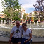
Later we drove across town to be with Dick and Elvia, a very special couple. Tom and Dick were high school classmates in Sacramento and they have stayed in touch. We stayed two nights at their house and had a wonderful visit with them that included a trip to a new shopping area in Boise (lots of fountains) and a baseball game—good seats right behind home plate– between the Hawks and Vancouver. Our time with them was filled with laughter and relaxation. It really helped us recuperate some from our lengthy driving trip. Elvia and I thought the sunset at the game the best part of it since the game itself was a bit slow—a lovely sunset!

Leaving Boise on a Friday we erroneously took Hwy 84 instead of Hwy 20 out of Ontario, just across the Oregon line. In Baker City we stopped for gas and also went into The Little Bagel Shop where we could smell REAL COFFEE—very unusual for our trip. Ahhh, we were back in the Pacific Northwest. Instead of coffee we had iced tea though and toasted bagels with cream cheese. The shop was in an old brick building which had been divided with a dining area on one side and the shop on the other. Baker City has a population of about 10,000 and has a large historic district. A sign said the bagel shop was closing at 2:00 p.m. on Friday and Saturday because of the heat.

My notes show that at 12:35 we were on Hwy 26 and in the Malheur National Forest. We drove through Prairie City where there were big green fields and views of the Strawberry Mountain Wilderness. We stopped in John Day to get snacks. And we passed a lot of bicycles spread over many miles as well as their support vehicle. Going over Ochaco Pass we could see the remains of a very large forest fire with smoke still rising in a few places. Finally we were passing through the town of Sisters, driving over Santiam Pass, down winding Highway 126 and home to Eugene.

A few things I learned from this trip.
1. We live in a very large country, much of which is either uninhabitable or very rural. I can see why these rural dwellers may have disdain for urban dwellers. Many of the huge farms must be owned by large companies.
2. Changes in time zones can mean you may or may not find a vacancy in a motel or campground.
3. Doves live and coo in most of the Southwest although their calls may differ a bit from place to place.
4. Invasive species such as Tamarisk and Russian Olives can use a lot of water and in some places people are trying to eliminate them. Junipers also use a lot of water and in some places people are trying to eliminate them as well, or at least reduce their numbers.
5. Fireflies are magical!
6. Cicadas are very loud.
7. Deserts are lands of contrasts, which, in the summer, can range from dust storms to cloudbursts with lightning and thunder and flash floods, nearly always accompanied by heat and humidity.
8. Cactus and desert landscapes have their own awesome beauty.
9. I don’t like most RV parks—they are too crowded and there is little privacy (I’ve known this for years!).
10. When a couple is traveling long distances in confined quarters they should factor in alone time to prevent murder.
11. When I’m in a place where the plants, trees and birds are unfamiliar I feel as if I’m in a foreign country and really want to learn their names.
12. Many people go out of their way to be kind at the times when we need kindness.
13. Nearly every town (from the Southwest to the Pacific Ocean) that I’ve seen has the same kinds of businesses on the outskirts of town—fast food places, auto shops, big box stores. Trade places with another town and you wouldn’t know the difference.
14. Don’t rely totally on your GPS, particularly on Los Angeles freeways.
15. Nearly every place has its charms, although I’m not totally sure about Branson, Missouri.
16. What you get out of a trip is what you put into it.
17. It’s good for the ego to be the minority race once in a while.
18. Seeing other places makes one truly appreciate the Pacific Northwest.

Would I do it again? Yes, but not in July. It would have to be in the spring or fall. And I would stay longer in places so that I could get a better feel for each place— see the way the slanting light changes the landscape during sunrises and sunsets. I would stay in more parks and fewer RV places. It was a good trip.

Arches National Park

Posted by Susy in Uncategorized | Comments Off on Arches National Park

Delicate arch

We drove as far as the campground in Arches National Park, turned around and then stopped on the way out at Wolfe Ranch. We’d left the trailer in the parking lot at the entrance as signage recommended.

The Wolfe Ranch was also the entrance to the trail to Delicate Arch. We’d expected a flat trail wandering out into the desert, an easy 3-mile round trip. It turned out to be a trail with some uphill climbs and a fascinating hike, beginning with the ranch house.

John Wesley Wolfe settled here, moving from Ohio, in 1898 with his eldest son Fred.
He was 69 years old with a leg injury from the Civil War and looking for a drier climate. His 100 acres had fresh water and enough grass for a few cattle, eventually growing to a large herd. The brackish water in the stream (Salt Wash) was enough for irrigation and the cattle and they used water from a  nearby spring for drinking. We saw some small fish in the creek. In 1906 Wolfe’s daughter and her husband and two young children arrived.
cabin and remnant of origina? 
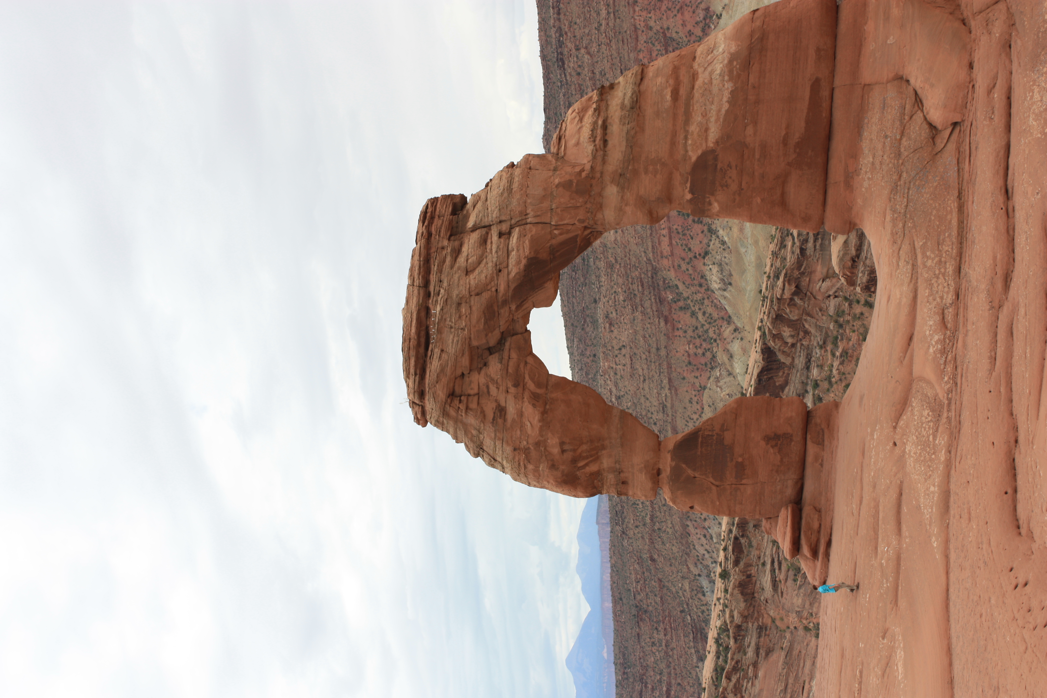
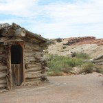
“Flora demanded they build a new cabin with a wooden floor and real windows.” The cabin that Wolfe built remains today. It is made of cottonwood logs and is 17 X 15ft. “He also constructed a root cellar, irrigation dams, and a corral. All six family members lived and slept under the distinctive thatch-and-clay roof for just two years….” At that time his daughter and family moved to Moab so the children could attend school. In 1910 the whole family returned to Ohio where he died at age 84. (This information is from a National Park Service website)

Petroglyphs #2
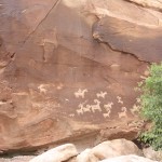
I’ve always wanted to see petroglyphs (not just on television or in books or magazines) and not far from the old house is a bluff where there are petroglyphs on a rock face! What a treat! I find it deeply moving that the need for expressing ourselves in art goes back to so long ago, as evidenced in caves in Europe. Utes camped near the Wolfe Ranch and traded handmade blankets for garden produce and meat. The fact that some of the figures are shown on horseback means that the artwork was done “after the mid-1600s when the native people acquired horses.” Other figures include bighorn sheep and dogs.

From the petroglyphs we returned to the main trail and began our hike. We were fortunate that the sky was overcast because otherwise the heat would have been more difficult for us. We’d had water before we left the car but figured three miles didn’t require water in hand even though rangers posted at the trailhead strongly suggested it.

The trail started at 4,300 feet elevation and climbed 480 feet. It wound over some small rises and then went fairly steeply up an expanse of sloping smooth sandstone (slickrock), a little like the glacier polished granite of the Sierras but with the red color of the desert. Here and there were small, rounded Potholes with water
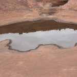
potholes holding water from the summer thunderstorms. As we were going up the rock others were coming down, but there was nothing except sky visible beyond the top of the rock—as if they’d just disembarked from a space ship. Soon younger people passed us on their pilgrimage to the top. Beyond that rounded summit the trail continued as did the small cairns we had been following. The other hikers were more scarce now. I was a bit ahead of my spouse and stopped now and then to snap a picture.
View from Delicate Arch area
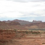
Finally the trail was a three-foot wide path that had been blasted out of the hillside, with a cliff above and one below. One more turn and there was Delicate Arch—and other hikers.

This view was worth every bit of the hike, the heat and the humidity. The surprise to me was that 80-foot tall Delicate Arch stands on an outcropping, solitary, with no support from either side. It’s just there. And someday it won’t be there as wind and weather wear it down. ToPath goes around a cliff
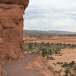
m and I didn’t climb over the edge and go down to stand under the arch and pose as many were doing but were content to sit and enjoy. We also enjoyed a little chipmunk that had obviously learned how to get free, although maybe lacking in nourishment, meals. It wasn’t just Delicate Arch that intrigued me about this area though.

As I looked down into the canyon below that path I thought about the Native Americans who used to roam these desert wilds and how well they had to know the land in order to survive. How they would know each spring and each pothole that might catch water from the stochipmunk at Delicate Archrms. How they would know the habits of the wildlife and where to find edible plants. How they would know the secrets passed down from one generation to the next, the holiness and the spirits of this place. And here we were, along with all the other tourists, coming to view the wonder of an arch, awed as we clicked our cameras, but then going on our way to photograph new scenes in the coming days. John Wolfe, who lived here many years, had seen sunrises and sunsets; had built a cabin from local wood; had learned what garden produce would grow in these soils and how to use the rare water sources; had watched the night sky and traded with the local Native Americans. No doubt some of this place had become a part of him, yet even Wolfe was just passing through

Traveling to Moab

Posted by Susy in Uncategorized | Comments Off on Traveling to Moab

outside of Blanding
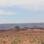
Before reaching Bluff (previous blog post), Utah, while still in Arizona, we passed some beautiful red-rock bluffs and the Anasazi Inn. We were at 6,000 feet elevation. Got gas an more iced tea in Kayenta. a Navajo Nation community near Monument Valley. Here were houses with red, blue and green roofs. “Kayenta is regarded as a political sub-division of the Navajo Nation.“ (Wikipedia) Hwy 163 took us through Monument Valley, a tribal park with lovely red-rock formations—spires, swirls. Then we were in Utah.

Mexican Hat is a little community on the San Juan River where narrow buildings (an inn) are perched on a narrow shelf above the muddy river. There is a steep pitch (10%) down to the bridge. Mexican Hat is named for a rock formation, that we did not see, where
a large, almost flat stone, about 60 feet in diameter, is perched upon a smaller one up on top of a hill of red rock. After we left this area we found a place to pull off and look at a map and also take more photos back toward the red-rock formations. Sometimes I just stuck the camera oelectricity for Teslasut the window and hoped for the best.

Our next town was Blanding, a nice little village where the visitor center has Tesla plug-ins! Went into the trailer to fix peanut butter sandwiches and carrots for lunch. It is near Blanding that some local ORV drivers recently challenged the closing of an old road to motorized vehicles. The Bureau of Land Management (BLM) is trying to protect numerous archaeological sites while some local citizens insist it is their right to drive in this area.

From Blanding we climbed higher and were soon in junipers and sagebrush. I enjoyed reading some of the names as we travelled and wondered where they came from: Devil’s Canyon Campround was an obvious one because it was in the Devils Canyon National Forest. Devil’s Canyon is dry most of the year but when flash floods occur it roars with muddy water. It was named by early settlers who had great difficulty crossing it. And to my delight we were once again seeing ponderosa pines. Bull Hollow Raceway, near Monticello, is one of Utah’s best motocross tracks and privately owned and operated. We had a great view of the mountain to our left where we had previously seen smoke from a forest fire.

Twenty-two miles from Moab we entered the La Sal Mountains National Forest. And crossed into another time zone.

Moab, now The town of Moab
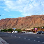
a town of mountain-bike riders, river rafters, and extreme sports enthusiasts was originally settled by Mormon missionaries in 1855, slightly north of the current town site, where they built a “stone fort, a stockade and a log corral for their livestock and immediately began to plant crops”. The local Ute tribe was friendly at first but before long attacked the fort and set fire to hay and corn crops. The mission was abandoned and “permanent settlers did not return to the region until 1877”. The new settlement was called “Moab”, or “land beyond the Jordan”, a Biblical land where Semitic relatives of the Hebrews dwelled.” http://historytogo.utah.gov/utah_chapters/pioneers_and_cowboys/thefoundingandnamingofmoab.html                 http://historytogo.utah.gov/places/moab.html

In the 1950s the economy changed from a community of farming, ranching and fruit growing to one supported by uranium and then potash.

We arrived at Canyon RV Park in Moab around 9 p.m. The  RV park is basically downtown and it was packed. Right next to us (and I mean right next to us—I could reach out from our table and touch their tent) was a middle-aged couple with a yellow Honda motorcycle and a little motorcycle tent trailer. Tom found out that they belonged to a Christian motorcycle group. The mostly young people across the narrow road from us were part of a group with a guide on a See America trip. They had done a river-rafting trip that day. One man, who seemed a little older than the rest, stayed in camp while the others went to take a hike at Arches National Park and it was he who gave Tom this information.

I felt the need for some alcohol and walked down to the store next to the RV park entrance and bought a bag of ice and a can of Sprite. Tom fixed highballs with the whiskey his friend Marty had given us in Huntington Beach. Certainly took the edge off my “surrounded by crowds” stress! I fixed a big salad for dinner and topped it with tomatoes and tuna. On the opposite side of us a young child was screeching.

It was hot again that night but I slept a little better than the night before. I got up early and walked a couple of blocks to find a trail the office clerk had told me about the night before. When I asked about a place to walk she started suggesting places to shop and I shook my head. Not what I had in mind. She understood and said if I needed a place to be around fewer people and buildings there was a trail just a few blocks down the street, a paved bike path along a small creek. The town of Moab, population 5,000 and elevation a little over 4,025 feet, is surrounded by red rock bluffs, an attractive setting, particularly in the evening and early morning when the slanting sunlight highlights the colors.

I walked about a mile up the creek, which still had a little water in it. The grass along the way was brown and dry but there were trees. Signs saMoab City park signid they were eradicating Russian Olive (an invasive species) and Tamarisk (also an invasive species that depletes groundwater). Some very large cottonwoods grew on both sides of the stream as well as mulberry, which had dropped berries on the pathway. The trail went past some houses that were fenced, and past the high school. Beyond the high school were red rock bluffs that apparently follow this canyon. When we had arrived at the campground the night before we could hear a band playing marching music and it must have been the high school marching band practicing. That was something that was actually kind of nice once I realized it wasn’t coming from an adjacent campsitThe Nibble Garden near Hi-school
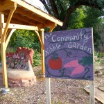
e! The high school had a “Nibble” garden along the trail where you can eat a bit if you so desire. A nice touch.

Tom fixed scrambled eggs for breakfast and we had that, a slice of bread and orange juice accompanied by the coffee I’d purchased for both of us at the store on my way back from my hike. Well fortified, we left Moab and decided we’d go to Arches National Park and then see whether we had time for Canyonlands.

Tuba

Posted by Susy in Uncategorized | Comments Off on Tuba

It was dark as I left my tired, cranky spouse in the car and crossed the parking lot to enter a store in the town of Tuba, Arizona to ask whether there was any kind of trailer park in town. The clerkNavajo trading post, who may have been just as exhausted from a day of work as I was from our long day on the road, noticed that I wasn’t even writing her directions down correctly. “I’m so tired I can’t see straight,” I said.
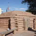
She gave me a measured look, took the piece of paper she’d given me when I’d said I needed to write it down and drew a line sketch of the streets. “Go back out onto this street, make a right and then go past the second stoplight and turn left; there’s a Quality Inn there and the RV park is behind that. There are only two stoplights in town,” she emphasized.

Back I went to the car, clutching the paper. We’d been on the road since the Grand Canyon, traveling along Highway 64 and steadily losing elevation. We had seen the Little Colorado River Gorge to our left with layer after layer of shades of tan, brown and red on vertical cliffs. At various scenic, and not so scenic, turnouts there were little Native American markets selling jewelry and other items, some closing as dusk deepened. We could smell fresh rain on pavement. At the sign for Cameron, we headed north. Cameron seemed to contain only a trading post and a restaurant. Just past Cameron were strange earthen mounds along the highway. This area seemed quite desolate with trailers and shanties scattered about as we went through a Hopi reservation.

We arrived in Tuba at around 9 p.m. on a Sunday evening. We’d had nothing to eat since breakfast except nuts and the bottle of orange juice that we had shared at the Grand Canyon in midafternoon. After one false try from turning one street too soon we registered at an office in the motel and then drove slowly through the very dark RV park. Apparently everyone there had already gone to sleep. We hooked the trailer up to electricity. The restrooms were accessed by using card keys like one uses in a motel. We also had to pay a $5 deposit for a little socket wrench to turn the water on by the trailer. That was a first! Then we walked around to the front of the motel (their nice restaurant had already closed) and, along with a group of young men (Portuguese perhaps?), we crossed the street to a McDonald’s. I think we both would have eaten anything that someone else cooked by that point. We each had a fish sandwich, a small strawberry shake and a lot of iced tea.

Back at the trailer it was very hot and muggy and sweat was just pouring off. I finally turned on the ceiling fan—bliss! I had no idea it was on full blast and noisy. Tom got up after while and turned it off because the noise was keeping him awake but at least it had cooled things down some and as lightning flashed off in the distance the wind picked up, cool air came through the screened windows and I could get a little sleep.

The next morning I woke before 6:00. It was light outside and getting warmer. I put a tablecloth on a table in a shaded empty site. The trailer park had some trees and wasn’t nearly as desolate as it had seemed the night before. The restrooms were older but clean. Doves cooed constantly there as they had through much of our journey. I sliced a peach we’d brought from Branson and half of a banana for fruit to put on the hot cereal I’d fixed in the microwave. We had that and orange juice.

My social husband was chatting with someone in a nearby site and I went off to look at the Navajo buildings that were right next to the Inn. He discovered that our nearest neighbor was an anesthesiologist from the state of Washington who was working there on a temporary basis and that another man in another site was an internist who was also from Washington. The anesthesiologist was puffing on a cigar.

It was getting very warm so I hurried over to the Navajo museum area, camera around my neck, notebook in hand. The two museums were closed but there was a pathway marked with interpretive signs that I began to read. A moment later I noticed a figure standing beside me. She was shorter than I am, over 50 years old, no doubt Navajo. We chatted for a few minutes. She tried to tell me about Navajo history in the area but her knowledge seemed a bit sketchy. I heard a loud knocking on a window from the Trading Post behind me. She glanced that way but continued to speak. Soon it was apparent that she was asking for money. I didn’t have my purse with me and should have let it go at that but she was persistent, saying she was really hungry.

“I’ll get something,” I said heading back toward the campsite to get some money.
“Be sure it’s Chicken McNuggets” she called after me.
“I’m not buying you food,” I answered, “I’m getting some money so you can buy food.”
I gave her $3.00 and thought, “Well if she’s being that specific, maybe she really IS hungry.” I also decided that the knock on the window must have been someone who worked at the Trading Post trying to tell her to stop bugging the tourists.

Some of what I gleaned from the interpretive signs: The Navajo called themselves Dine and they believe there are two classes of people: The Earth People and the Holy People. The Holy People are spiritual beings—they cannot be seen but can help or harm.
Navajo needs for growth include four values: life, work, social/human relations and respect/revold building in Tuba,erence.
Corn is an important part of Navajo prayers, the most basic medicine and food—divine.

One of the two museums features the Navajo Code Talkers. The Code Talkers, who came up with a code that the enemy couldn’t break, were vital to U.S. efforts in World War II. http://www.historynet.com/world-war-ii-navajo-code-talkers.htm The last Code Talker died in June of this year.code talkers museum

In 1956 Tuba was a uranium boomtown. Three hundred tons of uranium and vanadium ore were processed daily. In 1960 the uranium mill went bankrupt.

It is the Navajo Nation’s largest community. The town was named after a Hopi leader, Chief Tuuvi. who became a Mormon in 1870. Mormon settlers arrived and settled and then claimed all the land and water in Moenkopici Creek as their own.

The Trading Post, which was open, contained numerous handmade Navajo arts and crafts and I enjoyed walking slowly through and admiring them. I thought it a bit ironic that the young woman behind the counter had eyes only for her I-phone. The trading post was first opened in 1870 by Charles Albert. From the 1900s to 1910 one sack of wool was worth #3-$4 dollars. Teddy Roosevelt stayed at the post in 1913 when returning from a mountain lion hunt on the rim of the Grand Canyon. Later the trading post was owned by the Babbitt family until the Navajo Nation purchased it in 2000.

Disputes between the two tribes over thousands of acres in these pinon pine- studded, desert landscapes have been ongoing for over 100 years, stemming from a land allocation made by President Chester A. Arthur in 1882. http://articles.latimes.com/1993-10-17/news/mn-46610_1_hopi-land  Other information near the museums included the fact that in 1966 the U.S. Commissioner of Indian Affairs, James Robert Bennett, imposed a ban on new construction, water and electrical lines on large tracts of land unless it was approved by Hopis. Although this didn’t apply in Tuba, it restricted progress for the Navajos. The Hopi tribe opened a large commercial complex across the street from the Navajo Museums and Quality Inn in 2008.

Desert landscape out of Tuba
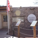
After returning our socket wrench, we left Tuba and began driving through sagebrush flats and again going past mesas that paralleled the highway. We crossed into Utah where bluffs were like sculptures in brown with beige washes in between. In Bluff, Utah we saw a Green Tortoise bus—those who are from the West Coast will understand our brief moment of recognition! Have never ridden one, not my kind of travel preference, but I guess it’s an adventure.

The Grand Canyon

Posted by Susy in Uncategorized | Comments Off on The Grand Canyon

Grand view

Did you know there is currently a proposal to build a tramway to the bottom of the Canyon, below the east rim, as well as a hotel? In addition more hotels, motels, RV sites, fast food restaurants and other development would take place on the rim above it. http://www.businessinsider.com/grand-canyon-escalade-gondola-2014-8?op=
This seems like sacrilege to me. I will probably never get to the bottom myself but I am excited for those who are able to do so now and in the future. Not every place has to be accessible by everyone.

In spite of seeing numerous photos of the Grand Canyon throughout my life there is no way I could have been prepared for the enveloping immensity of the colors, the time, the history, the depth. I really can’t describe it in a meaningful way. A friend said, “Well you can say it’s a great big hole.” Ummm, yes it certainly is. But I think if you stare at it too long it might swallow you. And you would respond to being swallowed by saying “Thank you”.

We parked out car and trailer in a parking lot above the main street of Grand Canyon Village, which was busy and hot. It was early afternoon. We weren’t sure of the process of getting there but knew we wanted to take a shuttle. After walking a short distance down the main street we stopped where others seemed to waiting, in front of a steakhouse. We had to have Golden Age passes or purchased tickets so we used our passes. It’s a 20-minute ride to the Visitor Center on the Rim. This reminded me of when we went to Yellowstone and wanted to see the geysers. You just have to realize it’s going to be insane with visitors and try to focus on what you came to see.

Once we reached the Visitor Center area, elevation of over 6,000 feet, we caught another bus to Yaki Point overlook and walked down the South Kaibab Trail maybe a quarter of a mile. The name Yaki comes from the Native American tribe of Yaqui Indians. There were a number of people but there were no buildings and traffic was just buses loading and unloading.

Even in that short quarter of a mile I could see how a person could just keep heading down, not wanting to stop. I also thought about what it must be like when mules carrying people come up and you have to share the trail. The trail was wide but the canyon’s depth is overwhelming. We took some photos and chatted with some other visitors. A young couple coming up the trail said they’d made it almost all the way to the bottom but I wondered whether that was really the case unless they’d started at dawn. It’s a long way down and even longer coming back in the heat. In just our short excursion we could feel the temperature getting warmer.There were signs everywhere about carrying water and most people clutched plastic water bottles as they roamed about. Every year someone dies on the trail due to being dehydrated, not realizing how quickly you lose moisture in such heat.

We caught another bus and went to another stop and took more photos. A young woman, who was part of an Asian group, took our pictures for us and also photos of another couple. She seemed quite adept in the way she went about it and I thought perhaps she was a professional photographer. The buses come by frequently, which is a great asset, considering the numbers of people to be transported and many possibly, like us, with very limited time.

We rode back to the Visitor Center and while Tom looked there I went to the bookstore for postcards and a book. We hadn’t brought water (although there was plenty in the trailer) and were very thirsty. I bought a bottle of orange juice for us to share. Our very short visit reminded me of some of the people who came to Crater Lake years ago when I worked there. They would take a look, maybe go to the visitor center, take some pictures and they’d seen Crater Lake. Sigh. But it was better than not going at all and if we ever go back we’ll go in the spring or fall. On the bus returning to Grand Canyon Village we met a couple who told us they had been part of the Rajneesh movement in Oregon a number of years ago. Nice people. The man lowered his voice when he made that confession. http://www.oregonlive.com/rajneesh/index.ssf/2011/04/part_one_it_was_worse_than_we.html
We had seen only a very small portion of the Canyon as well as only a small portion of the development along its South Rim. But I feel fortunate to have even had that glimpse.

When we arrived back at the village we immediately left to continue our journey. We stayed on Highway 64, which goes through the park and along the rim. There were some magnificent v2 Condors--better
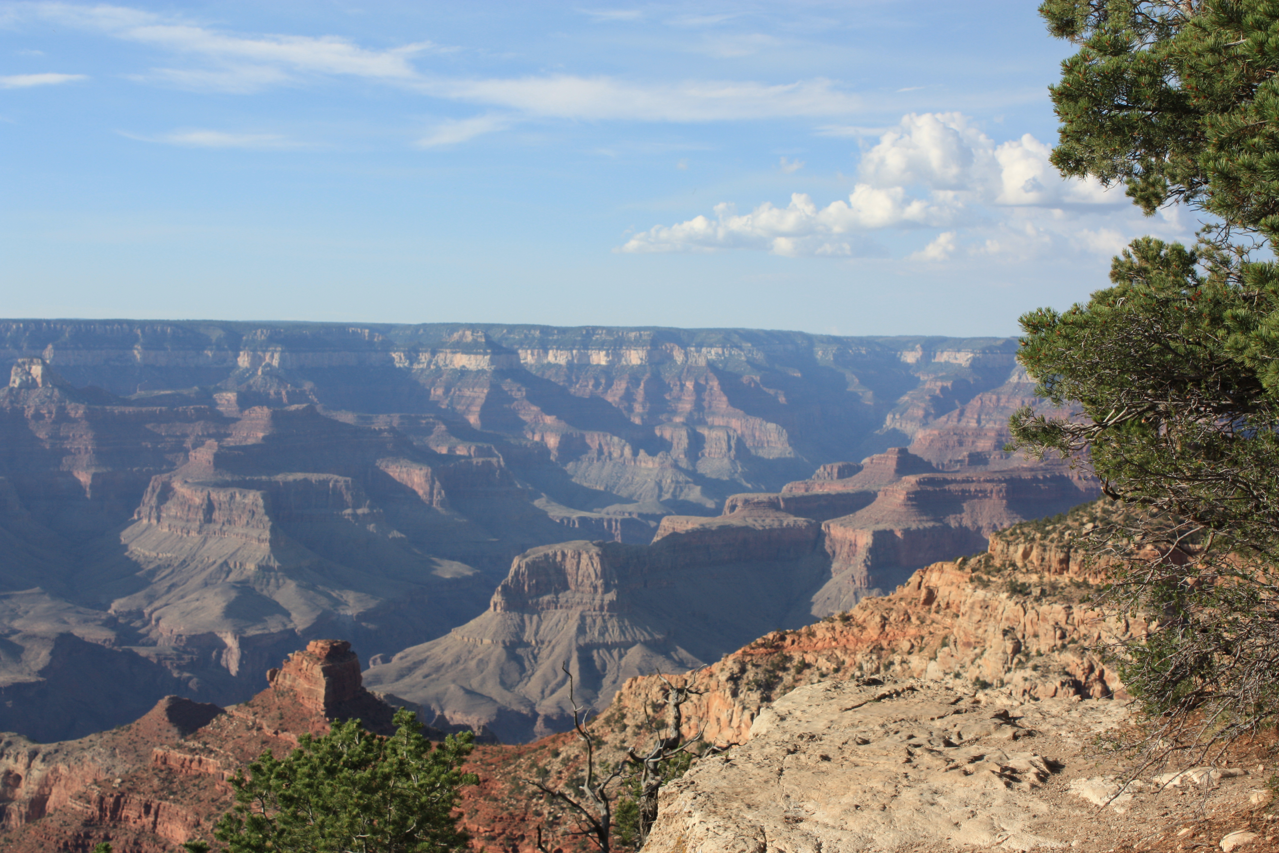
iews there and no crowds. In one spot we were able to see what we were sure were condors flying. In 1982 there were only 22 of these large birds in existence in the United States and the last one seen within 60 miles of the Grand Canyon was in 1924. Thanks to successful breeding in captivity and the release of adult birds about 70 now live in the Grand Canyon. They were released there because it offers ideal habitat for them.

The lighting along Highway 64 was better than it had been earlier because the sun was getting closer to the horizon and there was less glare. In one spot I ducked under some pine branches to get to another viewpoint and discovered elk scat just a few feet from the edge of the canyon. I told Tom later that I could just see an elk coming up to the edge, looking down and saying to itself, “Noooo, I don’t think I want to try that.” Or perhaps, “What a phenomenal view!”

Heading Southwest

Posted by Susy in Uncategorized | Comments Off on Heading Southwest

All of thHolbrook KOA-van
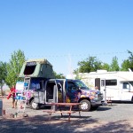
is constant traveling began to get to me every now and then. And I wasn’t even the one doing the driving! We did have a goal in mind though—we were heading for the Grand Canyon, which neither of us had ever seen. We had a couple of deadlines we had to meet that constrained our non-driving time: the first had been the date to pick up the trailer in Texas and the last was the time we’d arranged to see friends and my brother and his wife in Boise. Still, it seemed a bit crazy to me to be by passing interesting places. And if there is a next time we will be going in the spring or fall, not in the middle of hot, humid July.

Near Albuquerque I saw a sign saying “National Museum of Nuclear Science”. All the overpasses here were pink and blue. We passed the road to Petroglyph National Monument but didn’t have time to stop. Near Sky City Casino we stopped for drinks —we were constantly trying to stay hydrated—and met a couple from Phoenix who had a 1994 Casita. They were carrying bikes on theirs. They told us they bought it used and had fixed it up a lot.

Now we saw lava alongside the highway and a sign saying something about an ice cave. There were red cliffs off to our right and colorful terraces. One of the things I hadn’t realized before was how much color there is in the desert where banded rock is in view for miles at a time. We crossed the Continental Divide.

I saw a license plate saying “GOMOMGO.”

Near Gallup, which a previous sign had said was “Wild and Wooly”, the Running Bear Trading Post was looking for a silversmith. We decided Gallup, which seemed hot and dry and glaring in the afternoon sun, was a good place to get groceries so we wouldn’t be eating out so much. The trailer has a large refrigerator so we could get some perishables. We stopped at a Walmart and were surprised at how expensive the groceries were. It was crowded and noisy and I realized I had finally found a store I disliked more than Costco. Gas prices as we traveled were lower than West Coast, particularly in oil states, but perhaps food is more expensive.

By 5:40 clouds covered the sun. We were driving past Petrified Forest National Park in Arizona and had gained another hour, which meant it was 4:40. These time changes coming west were quite helpful when we were looking for a campsite because it’s harder to find a vacancy the later it gets.

The oil indicator on our car went on just before we entered Holbrook and Tom pulled into a Circle K to get oil. I had seen a KOA listed in Holbrook on a map but didn’t have the number so called the one where we’d stayed in Tumucari a couple of days ago and they gave me the local number. It was 8:30 now and we were more than ready to get off the road. I dialed, told a manager where we were and said we had a Casita trailer. She said, “We’re right across the street and I can see you from the office!”

There weren’t many trees in the KOA and there was a light right by our trailer (sometimes hard to sleep with too much light) but we were off the road. The elevation was 5,000 feet. The managers had been there for a number of years and they ran a little concession stand. So much for fixing dinner in the trailer! But we were tired, it was late, and it was good to talk to other people. We had hamburgers and then a root beer float (floats were only $2 each). The tables outside were covered with red-checked table cloths and were under a tent. This area was shaded by trees and they had a big chunk of petrified log that some youngsters were climbing on. It was said to be over 200 million years old. One person we chatted with at dinner worked with fiber optics for the very large wind turbines we’d been seeing and his wife used to be a chiropractor. Another couple was from the Netherlands and they had their 13-month old baby boy with them. There were strong winds that night, dark clouds and lighting flashes in the distance.

The next morning we bought breakfast here: pancakes, eggs and coffee for $5 each. We talked to a young couple from Michigan who were birders. She identified a white-winged dove and a greater tailed grackle as we sat there. An older couple from Needles, California told us a harrowing tale of having their RV roof peel back in a strong wind on a California freeway. Seeing this occurring, a construction worker got in his truck and roared past them pointing towHolbrook KOA Van #2
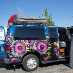
ard the roof. It turned out the roof had been installed with the wrong-sized screws

A brightly colored van with a tent on top attracted our attention. A throwback to the 70s! It was dark blue with large flowers painted on the sides. It turned out to be a rental van and the couple and their young daughter, who were renting it, were from France. They were traveling for three months in the United States. The tent was accessed by a ladder and folded down when they were on the road.

When we left we were driving through more sagebrush-covered flatlands although the road grade climbed gradually. A rest stop along the way offered red rock beauty. We crossed the Little Colorado River, which had a small amount of water in it. All the streambeds in this part of Arizona contained a lot of silt. When we passed the Twin Arrows Casino there was a great view of mountains toward Flagstaff. As we entered Coconino National Forest we were at the 6,000 foot elevation. Looking on the map I could see there are some high peaks in the area—Humphrey’s Peak at 12,633 feet; Kendrick PRest stop outside of Holbrookeak at 10,418 feet.

We eventually were in mountains—felt so good! We passed llamas with young ones, green meadows with mountains behind and finally were driving through mountains with aspen, grassy areas and ponderosa pines. There were signs indicating cross-country skiing and a Nordic center and an elevation of 8,046 feet. Then we headed down the other side into scmountain arearubbier vegetation and signs indicating we were in the Kaibab National Forest, which meant we were getting closer to the Grand Canyon.

“Cattle next 2 miles”, “Elk next 10 miles”. Off in the distance we could see smoke from forest fires at the base of a mountain, probably from the thunderstorms we’d seen from the KOA.

Oklahoma and Beyond

Posted by Susy in Uncategorized | Comments Off on Oklahoma and Beyond

warning signWe found in our travels that some Southwest rest stops are much different than ours on the west coast. For instance several had signs warning of possible dangers, particularly for pets or small children. I’m not quite sure how the scorpion got on this sign since it’s an arachnid with eight legs, not an insect with six.

A few days after leaving Missouri we learned that Joplin, Missouri had a tornado the day after we were caught in that windstorm just a short distance away!

We soon crossed into Oklahoma (and I wanted to sing “Oklahoma, where the wind comes sweeping down the plain…”) and observed a highway sign posted a maximum of 75 mph and a minimum of 50 mph. This was the first time I’d seen a minimum posted. In the driving rain we stopped at a tourist information station, used the restrooms, drank some of their free coffee, and learned we were traveling in the same direction as the storm, which now included lightning.

I called a KOA in Choctaw (named for the Choctaw tribe) and got a reservation plus directions. Along here was where we hit our first toll roads. It was $6.50 for our car and trailer. When we turned to find a place to eat lunch in Claremont we had to give the attendant our receipt. She gave us $1 back. We found umbrellas and walked to a Carl’s Junior where we had taco salads and iced tea. Claremont has a street named for Will Rogers and a little statue of him on a horse with the quote “I never met a man I didn’t like.” Will Rogers was born in this area, where his father had a large ranch. Both of his parents were part Cherokee.

Then back on the road. We passed Tulsa (skyscrapers) where there was heavy traffic and an ozone alert. Saw a sign saying Oral Roberts University. Here, in addition to the minimum/maximum speed sign was added “No Tolerance”. I guess that meant if you went over 75 mph you were in trouble and if you went under 50 mph you were in trouble.

We came to another toll station, then turned off onto Hwy 377/99 heading for the KOA and another toll booth. Here we got change back on our receipt–$3.25 out of $6.75 (fee is for the number of axles). We were passing through rolling hills now, lots of green grass and trees with now and then a pond and an occasional egret standing with its feet in the water, plus a scattering of oil or gas wells.

We passed the towns of Prague (established in 1902 and originally settled by Czech immigrants), Shawnee (which is in Pottawatomie County) and Seminole (named after the Seminole Nation) and a very large casino called, appropriately, Grand Casino. By 8 p.m. we were in the KOA.

The man in charge was very proud of his facility and when he guided us to our site on his ORV he explained that a new restroom/shower building had just been completed. He said it was new enough so it should still be clean. And it was. Now and then in these trailer parks people would come by and want to see what our trailer looked like inside and Tom was happy to explain Casita trailers to them. A couple from North Carolina, who were in a 32-foot trailer, came by here. They were thinking of downsizing. Well, one of them was.

The next day we bypassed Oklahoma City, with its skyscraper skyline. I saw a sign saying “Billy Walkabout Memorial Highway”. I was intrigued by his last name so jotted it down. After we returned home I looked him up and learned that Billy Walkabout “is thought to be the most decorated Native American soldier of the Vietnam War. He received the Distinguished Service Cross, Five Silver Stars, 10 Bronze Medals five with Valor device, one Army Commendation Medal and Six Purple Hearts. He served as an Army Ranger in Vietnam, Company F, 58th Infantry, 101st Airborne Division” (all this information is from Wikipedia). He was a Cherokee.

As we continued our journey I saw a number of billboards: Chisholm Trail Crossing, and Cherokee—Live Buffalo, Native American flutes, Homemade pies, Native American beadwork, Cherokeetrade.com. Another sign said Cheyenne & Arapaho College. We stopped in the town of Cherokee to get gas, a subway sandwich and iced tea. Tom had seen several dead armadillos along the road although I didn’t spot any.

By 2 o’clock we were back in Texas. As we drove past sloping land with scattered trees and heavily eroded gullies we came into areas with big circles of corn, watered by wheeled sprinklers. A massive, angular cross near a church must have been close to 200 feet high. We were 40 miles from Amarillo. Long lines of wind turbines, miles and miles of them, were off to ouCicada on the edge of a gas pumpr right, toward New Mexico.

We gained an hour as we crossed the state line into New Mexico. Trees sloped from left to right in the direction the wind usually blows. By 7 o’clock we were in a Motel 6 in the little town of Tucumcari, New Mexico. It wasn’t much more expensive than a KOA and Tom hoped he wouldn’t be kept awake half the night by cicadas. I didn’t hear them if I took my hearing aids out but they were VERY loud and constant. We’d heard them every night that we’d been in our trailer because we slept with windows open to counteract the heat. This must have been a hatching year. The nymphs live underground from 13 to 17 years (although some have yearly patterns) where they drink liquid from tree roots. Little damage is done to the mature trees although young ones may suffer some. The nymphs then emerge from the earth, cCicada on edge of gas pump #2
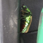
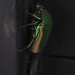
limb up on something, shed their skin and become adults. The males vibrate membranes on their abdomens to make the sound, which I thought sounded like a multitude of Rainbird sprinklers. These photos were taken on the side of a gas pump where we’d stopped to fill up.

We went to a roadhouse just up the street for dinner and beer. Tucumcari was named after nearby Tucumcari Mountain. In 1901, according to Wikipedia, the Chicago, Rock Island and Pacific Railroad built a construction camp near there that was originally called Ragtown. Later it became known as Six Shooter Siding because of all the gunfights. The name was changed to Tucumcari in 1908. This name may have originally come from the Comanche name of “tukamukaru,” which means “to lie in wait for something or someone to approach”.

When we first arrived in Tucumcari we noticed a Hampton Inn, not far from our motel, that had partially burned quite recently and asked about it. The previous week the inn had been struck by lightning! Fortunately all the guests were evacuated before the fire had burned very much. The building wasn’t more than two stories high.

The next morning dawned with strong winds and blowing dust. Blowing dust is a common problem in the southwest and there are frequent signs warning of the possibility of dust storms along the freeways. We drove for an hour or so before stopping for breakfast at a Denny’s in Santa Rosa. As we drove I saw an antelope resting on a small embankment not far from the freeway, the only one either of us saw the entire trip. Many of the overpasses were decorated with Native American designs.

Once again I took note of billboards: Flying C Ranch–Snake Stuff, Souvenirs, Sweet Treats, Serapes, Pottery, T-Shirts, Fireworks, Cool Treats, Guy Stuff. By 11 a.m. we were going through the little village of Moriarty in a big green valley with tall mountains to the northwest. We didn’t know this at the time but Moriarty, population about 2,000, has a Pinto Bean Fiesta in September and prides itself on: “Soaring (gliders), Bogging, Rodeo’n and Motorcycle Racing.”

I’ll end this section with a few more charming billboards:
“Bulls & females available—Fine Angus Cattle”
“Gallup is Wild and Wooly”